Sierra Trip 97 -- Kaweah Basin
Overview
You can jump directly to points in the trip by clicking on the maps above.
You can click on any of the photos to see a larger version, uncropped and uncorrected.
You can download the TOPO! source file to see
more detail in the maps.
You can see the raw photos here.
 |
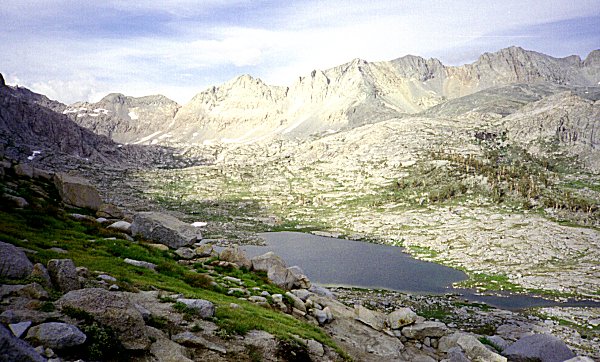
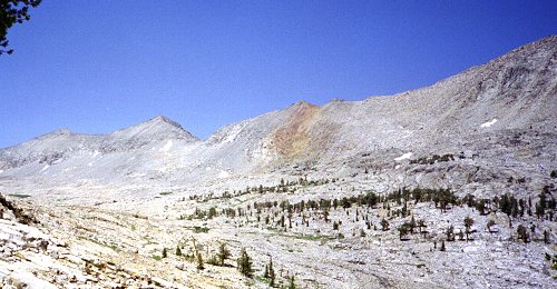
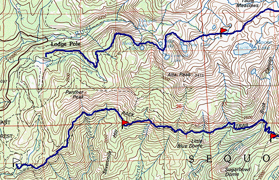
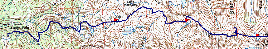
Map 1 -- Crescent Meadow to Nine Lakes Basin |
Aug 10
For several reasons, I could hardly wait until this year's backpacking trip to the
Sierras. Things at work were less hectic than usual, so I had the time to plan this
trip thoroughly. As usual, it was a blend of the familiar and the new. My
hiking companions were new, Lisa and Chris. They are experienced hikers and
climbers, but we have never traveled together, and they have never hiked in the Sierra
Nevada.
Lisa and Chris flew out to California a day before I did, to have an additional day to
acclimatize to the altitude. The plan was for them to pick up the wilderness permit
in the morning, then to drive to the airport in Fresno to pick me up, and for us to hike
in a few miles that afternoon. Things started falling apart right away.
Unusual weather at San Francisco airport restricted all flights to a single runway,
backing up all flights. My connecting flight to Fresno was several hours late,
apparently because the same aircraft shuttled back and forth between Fresno and San
Francisco, getting later and later each time. The schedule was so messed up that the
airline lost track of which flight was which, and told Lisa and Chris the flight had
arrived when actually it had yet to leave San Francisco. I was blissfully unaware of
their panic, when they could not find me.
|
|
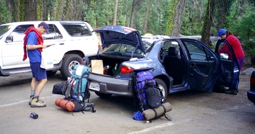
Finally I arrived, to find unusual weather in Fresno also. It was in the 70s, at
least thirty degrees cooler than usual for this time of year. I wondered if the
weather in the mountains would be thirty degrees colder than normal also. The delay
was not a catastrophe because Lisa and Chris already had the permit, had bought fuel, and
had everything ready to go. We drove to Crescent Meadow and quickly got onto the
trail -- at 7:00 PM. We hiked one hour in the twilight, then one hour more by
flashlight. We had a half moon and a good trail, and I was curious to see if we
could safely hike by moonlight alone. I found that wherever the moon was visible, it
was possible to turn off the flashlight and hike by moonlight. But most of the time
the trail was beneath tree cover, where it was quite dark. After hiking about
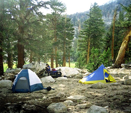
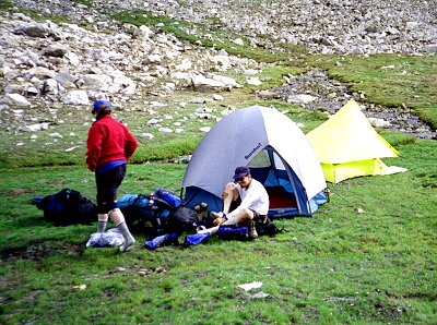
four miles, we found a good camping spot. We cooked dinner and hung our food by
flashlight and got to bed quickly. Fortunately we had the foresight to bring enough
water to cook dinner and breakfast, because there was none nearby. |
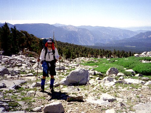
Aug 11
We all woke early, sleeping well considering the time and elevation change. All
of us staggered under the heavy load of twelve days food and gear. We moved
relatively slowly, along the pleasant trail. We all enjoyed the easy gradient and
superb construction of this section of the High Sierra Trail.
|
|
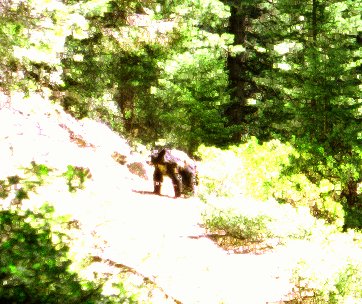
We saw an adult bear
and two cubs. They were on the trail, and did not seem to be in much of a hurry to
move out of our way. We also saw lots of lizards, a great variety and profusion of
wildflowers, and more water than usual for this time of year. All the people we saw
along the trail were heading out. When we reached Bearpaw Meadow campground, it was
almost deserted, and we picked the best spot. A large group of Scouts, on their way
to Mt. Whitney, dribbled in bit by bit all afternoon. We strolled over to the High
Sierra Camp, and hung out on the porch for a while, enjoying our last chance to sit in
chairs and get water from a faucet. I had originally intended to come back at
midnight (after the moon set) to watch the meteor shower, peaking this evening. But
after getting in my sleeping bag, I slept right through it. |
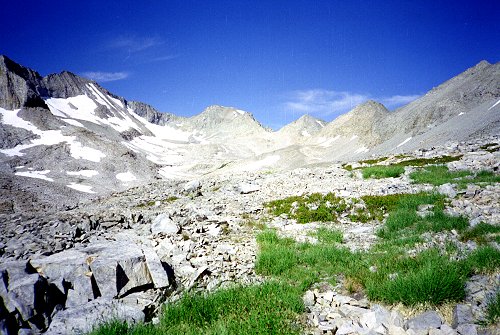
Aug 12
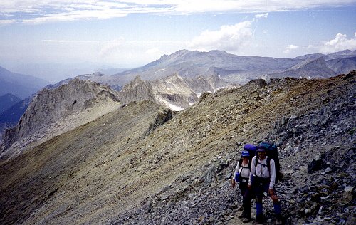
| Today's climb is the biggest of the trip -- 3000 feet. |
|
|
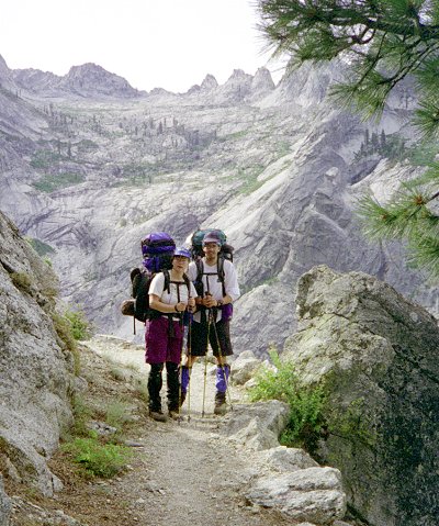
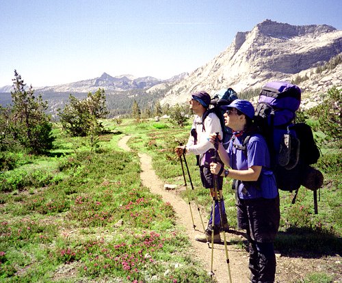
Lisa and Chris with Kaweah Gap in background |
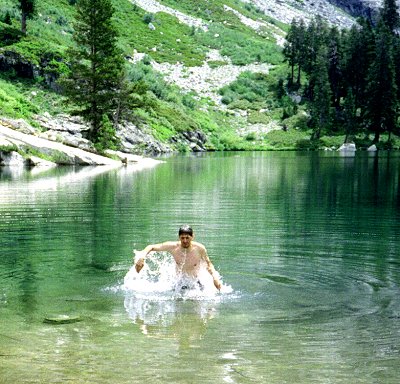
| We got started a little late, arriving at Hamilton Lake for lunch. The water was
almost warm enough to swim in, and we all soaked our feet. Chris went all the way
in. We saw a good sized snake by the lake, and fish swimming through the clear
waters.
The Scouts overtook us, and pushed on ahead while we relaxed by the lake. We
passed, and were passed by parts of this group the rest of the afternoon. We
discovered they were headed for the Nine Lakes Basin that evening, and were then planning
to cross Pants Pass the next day. We reevaluated our plans to camp in Nine Lakes on
hearing this. The climb, which I associate with a dusty trail and a merciless sun,
was made more pleasant by an overcast sky. |
|
|
Chris at Hamilton Lake |
|
|
By the time we made it to Kaweah Gap, the Scouts had claimed the lakefront campsites,
so we headed on down Big Arroyo, camping on a moraine near the trail. This turned
out to be a favorable campsite -- reasonably near water, with good views, and a breeze
that kept down the density of mosquitoes enough that I could sleep outside the tent.
It also had a few trees suitable for hanging the food, which are absent by the lake.
On a previous occasion, I had been
visited by a bear at Nine Lakes Basin, and had been forced to stay up the rest of the
night guarding the food. |
Aug 13
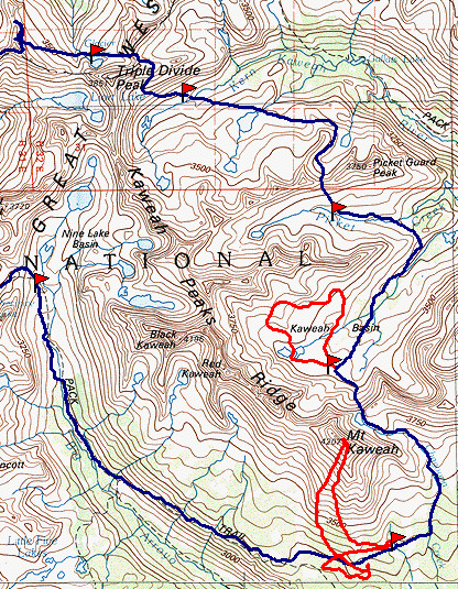
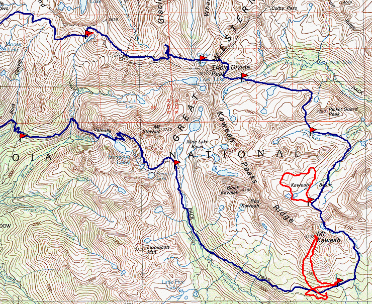
Map 2 -- Nine Lakes Basin to Glacier Lake
| We all slept late, after the hard day yesterday, as if we had agreed to do so
beforehand. The scouts passed us, having decided that Pants Pass looked too
extreme. I agreed with them. I really don't know how we made it over way back
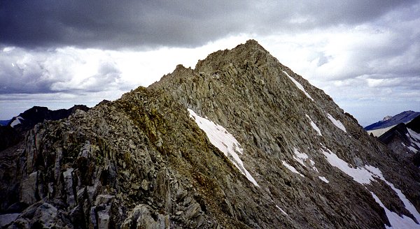
when I was a teenager with my dad. We admired Black Kaweah and Red Kaweah, which had
been in sight ever since Bearpaw Meadow. Strangely, we had been trying to identify
Bearpaw all along the trail yesterday, and could never spot it. |
|
|
Campsite in Big Arroyo |
|
|
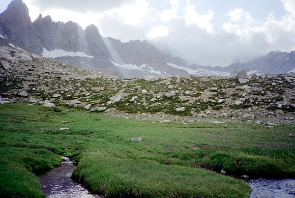
We traveled down Big Arroyo, admiring its beauty but fighting increasing
numbers of mosquitoes. As we started climbing up to Chagoopa Plateau the number of
insects diminished, as did the number of hikers. |
| While we were stopped for a rest, a curious hummingbird checked us out, coming back
again and again. Maybe it was putting a dent in the mosquito population. |
|
|
Chris and Lisa in Big Arroyo |
|
|
After arriving on the plateau, and passing the dry lake, we turned off the trail and
headed for the small lake on the creek just west of Chagoopa Creek. Chris's
watch-altimeter came in very handy for navigating to this lake -- we ascended to the
desired altitude and contoured around, coming out exactly where we should be. For
the first time on the trip, I was forced to put up my tent as refuge from the
mosquitoes. Lucky I am insensitive to their bites -- Lisa reacts to the bites and
must stay covered up more carefully. |
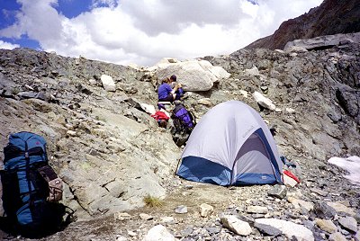
Campsite near Mt. Kaweah |
|
Aug 14
Chris and I are headed for Mt. Kaweah. Lisa did not sleep well, and decides to
stay behind and sleep in. We agree that we should be back by noon, and that she
should not start to worry before 2:00. That should give us plenty of time.
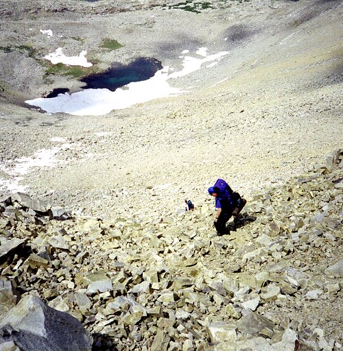
We made good progress up the south face, first through open forest, then up
increasingly steeper and steeper talus, decomposing granite, and more talus.
Everything was relatively firm, just a lot of climbing. We reached several false
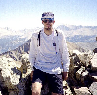
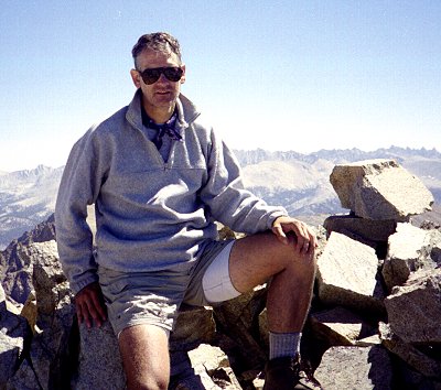
peaks, and finally attained the actual peak by about 11:00.
|
|
|
Chris on Mt. Kaweah |
Charlie on Mt. Kaweah |
|
|
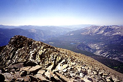
It was still pretty clear, and we had great views in all directions. We
identified Mt. Whitney on the eastern horizon, Black Rock pass in the south, and various
points on the Kaweah Peaks Ridge. But we were especially interested in checking out
Kaweah Pass (tomorrow's route), Pickett Ridge, and Triple Divide Pass (subsequent days
journeys). We signed the summit register, noting only a few other parties in
1997. I found my entry, from the other time I had climbed the peak. |
|
|
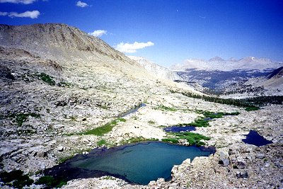
|
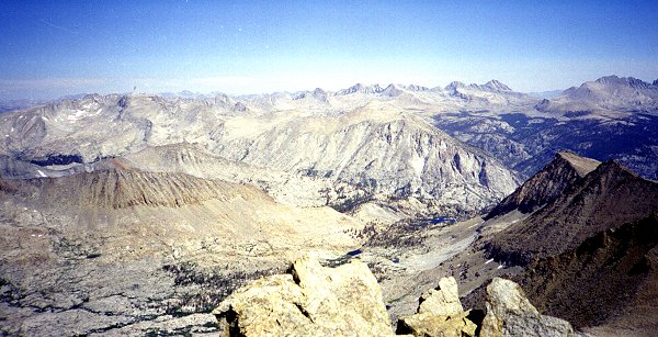
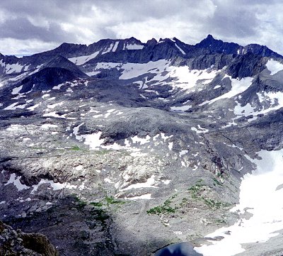
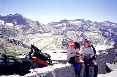
Chagoopa Plateau Kern River basin in the
background
Big Arroyo to the right |
Kaweah Pass from Kaweah Peak |
We descended after eating lunch, taking a more direct route down, staying on the sandy
decomposing granite. Once we got to the desired altitude, we headed back towards the
lake, as before. Although the terrain looked familiar, we never found yesterday's
footprints. After a while, things began to look unfamiliar, then very
different. According to the altimeter, we were at exactly the desired
altitude. After coming to a good sized creek, I decided we had either (1) gone too
far, missing our creek; or (2) were at the wrong altitude. First we tried following
the creek up, and discovered an interesting tree house -- a platform built between three
trees, with a floor, walls, a roof, and a ladder for access. This was at a meadow,
but not the lake we were looking for. Upstream looked steeper and less promising, so
we turned around and searched downstream. After a half hour, this looked unpromising
also. So we headed back, looking for a different stream. We zigzagged back and
forth a few times, eventually running across the High Sierra Trail, at a point somewhere
beyond where we had turned off it. Now it was clear that the altimeter was off -- it
said we were at our desired altitude, even though we had to be several hundred feet
lower. We considered going all the way back to where we had turned off yesterday,
and retracing our steps, but it was already 4:00 and we were anxious to get back.
Without the altimeter to confuse things, we found our way back to camp pretty directly,
arriving at 5:00. Lisa was, of course, concerned. She had been searching around for
us for three hours, but of course there was really nothing she could do. One of
those new family-band radios might have come in handy -- or perhaps not. Ultimately
I blame myself for relying on technology. The last time I climbed Mt. Kaweah from the same
lake (alone), I took my more detailed maps (this time I brought only the fifteen
minute overview map), I made careful mental notes, and I checked my compass
frequently. The lesson ? Pick one: (a) never rely on technology, which may
fail; or (2) next time bring a GPS -- it would have gotten us back with no trouble.
Our punishment: there had been no mosquitoes at the lake all day long. As soon as
we arrived, they came out in droves. Back into the tents.
Aug 15
|
|
The destination today is Kaweah Pass. On the map the climb looks moderate, but
in reality it is a continual climb, up a succession of stairsteps with meadows or lakes in
between. The forest gives way to runty trees, which yields to shrubs, which thin out
eventually to bare rocks. |
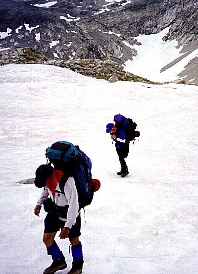
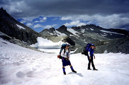
| At the higher elevations we cross our first substantial snow fields, which are easier
hiking than the rocky slopes they are covering. The snow fields cover more and more
of the route, substantially speeding our progress. |
|
|
|
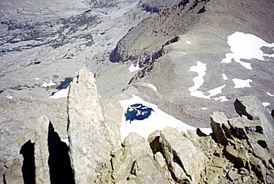
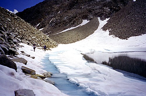
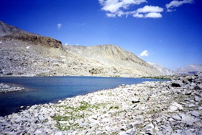
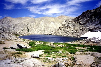
At the highest lake, right at the pass, we met two hikers coming across the pass in
the other direction. the lake was almost completely frozen, greatly simplifying the
job of getting around it. It had the prettiest blue-green hue where pools of melted
water had formed on the ice. |
|
|
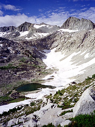
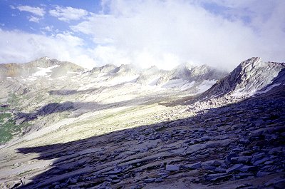
Upper Kaweah Basin from Kaweah Pass |
|
|
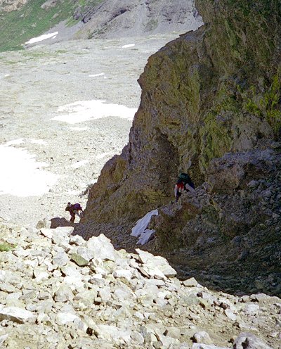
Descending Kaweah Pass was hair-raising because of the loose rock and the very steep
slopes. It was very tiring, but at the same time the clouds were threatening rain,
so we had to keep moving. Luckily I had descended this pass before, and remembered
the second set of cliffs below, as well as the route around them. In descending, I
slipped on a loose rock, landing on my butt. The combination of sharp rocks and
heavy pack caused more damage than wold have otherwise have occurred, but I did not have
time to stop because a huge storm was quickly approaching. |
Descending Kaweah Pass |
|
| Here we are between the cliffs of Kaweah Pass, above and to the right, and the cliffs
lower down in Kaweah Basin. Looking back up, none of us could understand how
we made it down the cliffs at the top. |
|
|
|
We stopped at the first possible spot, flung up our tents, and dived inside. For
the whole rest of the afternoon the storm stayed put, just beyond us, disappearing
completely at sunset. I put my tent away and slept under the stars. |
|
|
Clouds Descending Kaweah Basin |
Aug 16
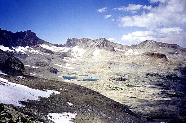
Our plan called for two easy days in Kaweah Basin. After the harrowing descent of
Kaweah Pass, we were all ready for a rest, so we decided to stay put. We slept late,
rested, talked, rinsed out clothes, and sat in the sun. We were all a bit stiff from
the accumulation of all the hiking and heavy loads. I had planned to explore upper
Kaweah Basin, but it was 2:00 before I got around to putting on my boots. I visited
each of the major lakes in the upper basin, admiring their beauty and sense of
remoteness. I was looking for alternative ways to cross over to Pickett Creek, but
there were no obvious passes in the upper part of the basin.
Although we again observed much cloudiness in the afternoon, we again had no rain and
clearing weather after sunset.
|
|
|
Two views of Upper Kaweah Basin |
|
Aug 17
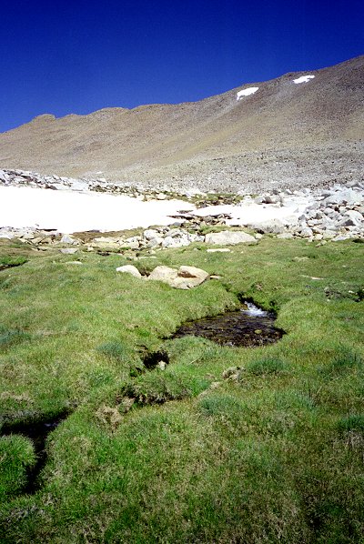
This is the coldest place we have camped. The stream nearby is covered with a
layer if ice, as it had been yesterday. This ice is surprisingly thick, and forms
beautiful patterns. It is a few inches above the water level. I guess that as
the temperature drops the stream flow slows, the ice forms, and the water drains from
below it. Since the water comes primarily from the snow bank a few yards up the
hill, it makes sense that the stream flow would be cut greatly at night. That is my
theory, anyway.
| Our packs finally seem a little lighter -- the food is half gone. Today we
descend to the lower basin, crossing the low pass to Pickett Creek basin. We have
two choices -- descend to the Colby Pass trail, or head up Pickett Creek and cross the
ridge. After descending Kaweah Pass, I would not be surprised if Lisa or Chris (or
both) wanted to take the easier route. But no, they want to go across Pickett Peaks
Ridge, so we head up the creek and camp just below the point we have chosen to
cross. The mosquitoes were thick, but disappeared at nightfall, leaving me to sleep
in peace. |
|
|
Pickett Peaks Ridge Route is over
the low point to
the left of the red spot. |
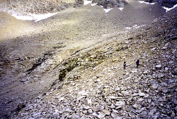
Aug 18
|
|
The mosquitoes reappeared at sunrise, but thankfully did not follow us when we left
camp. We had been studying the route of ascent yesterday, from several vantage
points, and it looked difficult but doable. (By contrast, our route of descent from
Kaweah Pass looked utterly impossible.) Actually it was easy, with firm
footing. The other side was much steeper, starting with a 30 foot cliff immediately
below the pass. We were sure we could descent a crack without the packs, and
pondered whether we should lower them on ropes. I explored around, and eventually
found that by ascending the ridge a ways I could descend a diagonal crack to the base of
the cliff. We all climbed down this crack, and descended into upper Kern-Kaweah
Basin. |
Upper Pickett Creek |
|
|
|
As we contoured around the valley, Triple Divide Peak, and our route up triple Divide
Pass, came into view. We stopped often to study the route, especially from the
heights of Pickett Ridge. The route up Triple Divide Pass tomorrow is the crux of
the trip. I had studied it on the topo maps, I had made perspective renderings of it
from many points of view, and plotted our potential course. Now we are seeing it for
the first time. The whole canyon of the Kern-Kaweah has cliffs on its west side,
except at this one spot. The route leads up this break, up a steeper middle section,
then over the east ridge of Triple Divide Peak onto the north slope, and up that to the
pass. The lower third looks easy -- there is a definite green color to it.
That leads to the steep section, which is partly covered by snow fields and seems to be
partly hidden behind a ridge. Maybe we can climb up behind the steepest part, but we
cannot see that. The final third looks tricky, but perhaps we can cross diagonally
up a rock slow directly beneath a cliff, up to the ridge. |
Upper Kern-Kaweah Basin |
|
There is an alternate route to the pass described in one of the climbing guides.
It starts at the Colby Pass trail (above the level of cliffs) and contours around from the
south, all the time staying above the cliffs. From here, it looks extremely
doubtful, long and tiring, with many spots that look impassible.
Again we have a chance to bypass Triple Divide Pass, going over Colby Pass on the trail
instead, and heading up Cloud Canyon. Encouraged by our success on Pickett Peaks
Ridge, we decided to go for Triple Divide Pass.
| We camped just below the Pass, where we could get a good look at it. |
|
Aug 19
It was cold again last night. I had ice covering much of my sleeping bag in the
morning. I assume it is my own perspiration, passing through the bag and freezing on
the outer surface. Inside, I am pretty warm, except when I move and bits of ice fall
into my face. We are all psyched up for the pass today. We are sobered by the
realization that each of the three sections today is as much climbing as yesterday's
ascent of Picket Peaks Ridge. We get going early.
|
|
The first third of the route, up the lower slopes, was long and tiring, but time semed
to pass quickly. Every day, we benefit from better conditioning and especially
lighter packs. |
Upper Kern-Kaweah Basin
Pants Pass on the skyline.
From the top of the lower section of
Triple Divide Pass. |
|
| The next section started with the snowfield, then required climbing steep cracks, a
few feet wide and filled with rocks and rubble. This kind of climbing worries me
because it is so steep, but because we are surrounded on three sides by walls it does not
seem that dangerous. I tested that theory by stepping on a rock that gave way,
slipping a couple of feet and banging up my shins. The damage was more psychological
than anything else. Lisa and Chris, more experienced rock climbers, enjoyed this
section the most. Happily, as each crack system petered out, another one was visible
to the left or right, so we ascended right up the steepest part. |
|
|
Snowfield in middle section of
Triple Divide Pass |
|
|
The upper third was less steep, less exposed, slab and boulder fields. |
View down middle section to the
Upper Kern-Kaweah |
|
| We finally got to the ridge just about exactly where we had intended, although it was
hard to tell where we were relative to our plan as we were climbing. The climbing
guide instructions are to descend, traverse the upper part of a bowl, and ascend the pass
itself. The trouble is that the bowl is covered in snow, all the way up to the pass,
and it looks far too steep to climb. Luckily, we can ascend the ridge we are on (the
east ridge) until it joins the main (north) ridge. Then, according to our plan, we
will leave our packs, proceed up to the peak, and return to pick up the packs, and
continue along the ridge to the pass. |
|
|
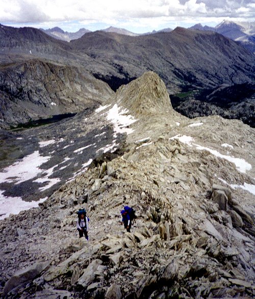
East Ridge Triple Divide Peak
Normal route would be to cross the ridge to
the North ridge. |
|
|
Just as we reached the junction of the two ridges, preparing to head for the summit,
it started to rain, which quickly turned into sleet. Distant thunder turned into
nearby thunder, and we abandoned plans to summit and began to descend. The west side
of Triple Divide Pass was very steep but short, scary, but after the past few days it
seems routine. The rain and sleet stopped and started a few times, as we rushed down
the rocks and snow fields toward Glacier Lake. |
Triple Divide Peak |
|
|
|
Approaching Glacier Lake beneath Triple Divide
Peak
Coppermine Pass route is in the background. |
| We found a flat perch, just big enough for Lisa and Chris's tent, next to Glacier
Lake. I could not find a spot big enough for my tent, so I nestled my sleeping bag
in a crack, counting on the weather to clear in the evening. I rinsed out my
socks and shirt, which by this time were stiff. I have never experienced water so
cold -- I thought my hands would never regain their circulation. For the rest of the
afternoon, evening, and night, I watched worriedly as big black clouds blew up the canyon
and passed over Triple Divide Peak. Fortunately, none of them dropped any
precipitation. Unfortunately, my socks were still wet in the morning. |
|
Aug 20
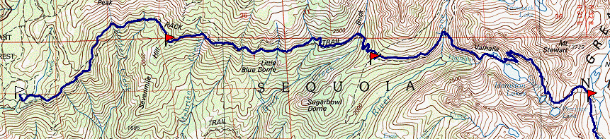
Map 3 -- Glacier Lake to Wolverton
This is a long day: cross the head of Cloud Canyon to Coppermine Pass, then cross the
head of Deadman Canyon and cross over to Lonely Lake. The goal is to avoid losing
altitude on each of these crossings. The higher crossings are steeper, more likely
to be covered with snow fields, and tend to have loose rock. We tried crossing high
in Cloud Canyon, but had to descend more than we would have liked. We could see some
footsteps through a snowfield much higher, but were unwilling to gamble on such a steep
slope. We were heading for the (old, unmaintained) Coppermine Pass trail, which I
remembered was just below a notch in the black section of the ridge. As we neared
this landmark, we found the trail. What a relief. We followed the trail as it
switched back and forth up he slope, until the trail disappeared into a snow field
directly below the notch.
|
|
I recalled that the extreme upper part of this trail was mostly missing, was
very steep, and went up the notch. So we just went right up the snowfield to the
notch, and climbed the notch. It was a lot more difficult that I had remembered, and
it took up a long time to get up it. A week ago, we would not have even attempted
this. I assured Lisa and Chris that this was the right way, and although we never
saw the trail again we constantly came across spikes, pieces of wood, and other remnants
of the mine. |
Lisa (below) and Chris ascending the notch. |
|
After we got up to the top, we found to our horror that the other side was sheer cliffs
-- no sign of Coppermine Pass trail. So back down we went -- almost as difficult as
going up. We picked another likely-looking point on the ridge line, traversed over
under it, and climbed up. There were some rusted cans, other bits of trash, but
again no trail, only cliffs. I took off my pack and explored along the ridge, while
Lisa and Chris explored the ridge in the other direction. Eventually, at about the
same time, we both spotted the real trail on the back (Deadman Canyon) side of the
ridge. It was on the other side of the notch from where we were. Knowing this, we
then spotted the trail emerging from the snowfield on the Cloud Canyon side. It had
taken a switchback underneath the snow, and headed way off the other way. As we
climbed back to the trail, we noted that from no other vantage point could we see this
trail. And the trail winds up ascending, not the notch in the black rock section,
but the highest part of the black section, just fifty yards from the notch. It was
as steep as the notch itself, but there were remnants of a trail, making its ascent much
easier. Even if we had known we were so close to the actual pass, we could not have
climbed from the notch to the ridge -- its sides were too steep and too high. The
notch was formed by a band of green rock, softer than the surrounding black stuff, and the
miners must have spent time exploring the area, leaving a lot of debris behind.
| Once we finally got over the right pass, the section along the ridge to Deadman Canyon
was a pleasure. There is such a feeling of height, with great views in all
directions. We hiked along the ridgetop trail, to just above the mine. The
route was covered with steep snow, but in the late afternoon sun the snow was soft and we
had no trouble descending safely. |
|
|
Coppermine Pass Trail |
|
|
The Coppermine trail continued on down Deadman Canyon, something I had never observed
before because I had been determined to stay as high as possible. This time we
followed the trail, descending until it was clear that the trail was heading down the
canyon, not across. Crossing a little lower was much easier. We even came
across the Elizabeth Pass trail, following it for a few hundred yards until it started its
steep climb up the pass itself. |
Coppermine Pass
The pass crosses the skyline at the
snow patch, to left of center. |
|
Hurrying along, we crossed over to Lonely Lake just as the sun
was setting. Again, we found a perch on a slope above the lake, just big enough for
Lisa and Chris's tent. Strong winds, constantly blowing clouds overhead, persisted
all night. I just pointed my feet into the wind, nestled into my bag, and slept
soundly al night. Lisa and Chris had to listen to their tent flapping the whole
night long.
Aug 21
Although it continued to blow, we headed up to the beach at the head of Lonely Lake to
wade in at the sandy beach. Actually I was the only one willing to go in, and only
for a minute. It felt nice to wash my feet, and splash my arms, legs, and
face. The water was very cold.
| From Lonely Lake, we descended and then climbed Pterodactyl Pass. We all debated
the name. Was the pass the wing, or was it the neck and head of the Pterodactyl
? |
|
|
Pterodactyl Pass |
After crossing the pass, we wandered up across the slabs, and to the ridges. We
could see Moose Lake in the distance, but everything else looked pretty dry. A lot
of (former) lakes and meadows were dried out, and there was little remaining snow.
This stood in contrast to areas at a similar altitude farther east, where there was plenty
of snow on the ground. As we circled around the Tablelands, we came across more and
more lakes still filled with water, although the exit stream of many had stopped
flowing. After wandering almost all day, we decided to stop at a pair of lakes on
the cross-country route between Pear Lake and Moose Lake. Even though the Tablelands
is a popular and relatively accessible off-trail area, we were unable to find an
established camp site near these lakes, so we stopped at a rocky spot between the lake and
on the threshold of the great drop-off to Pear Lake and the country below.
|
|
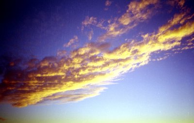
We had been smelling smoke off and on during the day, and once we looked down into the
lower country, we could clearly see smoke from a fire in the forests beyond and south of
Pear Lake. The smoke was rising vertically to a certain level, and then blowing
horizontally to the north. We witnessed a spectacular sunset at the sun passed
behind this smoke. A while after the sun set, its light passed through the smoke and
illuminated the clouds above us, creating first orange and then purple highlights.
We wondered where the fire was, and whether it would be blocking our exit on the Pear Lake
trail. |
|
|
|
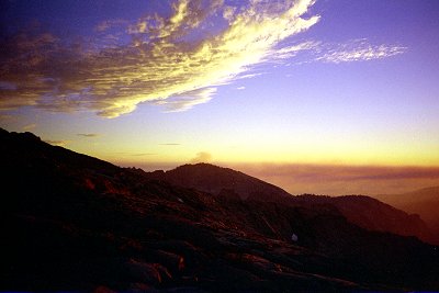
At the start of the trip, the moon had been been half full, and set about
midnight. Each day it set an hour later, becoming fuller each night. In the
Kaweah Basin it was rising shortly after sunset, and was so bright that it was sometimes
hard to sleep at night. It is amazing how bright the moon can be in the high
country. Later, the moon began to rise longer and longer after sunset, so we had
some respite from the bright light. Finally we could lay and admire the stars.
Unfortunately, around this time, it began to be overcast at night, so we did not really
get to see the spectacular night sky until the last evening. We had been looking for
Mir, which is supposed to be spectacular, but never did spot it. On this final
night, just as the clouds were their most beautiful, we saw two jets fly by in close
formation, apparently a tanker and a much smaller jet, apparently refueling. During
the time we were out, we saw many aircraft: lots of commercial jets flying high overhead,
small military jets flying much lower and faster, several helicopters flying very low
(many were below us), and countless more we heard but could not see. The noise from
aircraft is the an intrusion into this wilderness, the most obvious sign that life is
going on in the rest of the world.
Aug 22
The sun woke us all early. I can hardly believe the trip is almost over. We
have had wonderful weather -- much concern but no serious storms. This morning looks
to be sunny and warm, like every other. The packs seem light and spacious. We
have not seen anyone since that day on Kaweah Pass a week ago. And those were the
only people we have come in contact with since we left the trail on the third day.
Now we will be descending into populated regions once more.
The descent to Pear Lake was quick and painless. We are
all in much better shape than when we started. We remarked on the first descent
below 10,000 feet in a week, the first sight of other hikers, the first outhouse.
The stone outhouses at Pear and Emerald Lakes were pretty amazing. We passed
countless dayhikers, and fund ourselves more and more anxious to get back.
We had left the car at Crescent Meadows, where we had originally intended to
return. Along the way, we decided to return via Pear Lake, because it is so
beautiful. But this left us miles from the car. As we were leaving Crescent
Meadow, I had noticed a bus stop for a shuttle bus -- in fact we had parked right beside
it. Meeting a backcountry ranger on our way down from Pear Lake, we asked her if the
bus stopped at Wolverton (the Pear Lake trailhead). She thought not, meaning we
would have to hike an additional couple of miles back to Lodgepole. By good fortune,
we met up with the same ranger just as we were nearing the parking lot, and she graciously
offered us all a ride to Lodgepole. She is the one who had issued our wilderness
permit two weeks ago; we had a nice chat, and were very grateful to get a lift back.
|
|
Back at Lodgepole, we had enough time to get a snack (each of us was craving different
things), call home, and get souvenirs before the bus arrived. On the ride to
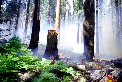
Crescent Meadow we learned that the fire was actually a controlled burn in the Giant
Sequoia grove near Crescent Meadow, and we actually drove right through the burning
area. This fire, closely watched by a squad of firefighters, was burning the pine
carpet, the brush, all the downed wood and dead trees, and was actually burning up the
side and in the crown of one of the Giant Sequoias. We could feel the intense heat
as we passed. |
| When we arrived at the car, it was covered in ash. |
|
 Go
back to Charles Hayden's Home Page
Go
back to Charles Hayden's Home Page
cchayden@gmail.com