Sierra Trip 94 -- Kaweah Basin
Looking over the maps of Sequoia-Kings Canyon, the Kaweah Basin called to me. It
was the largest trailless area that I had never visited. I had been all around it,
but never into it. In 1986, I crossed the
Chagoopa Plateau, looking up at Mt. Kaweah and imagining that I would one day return
to climb it. So I resolved to explore Mt. Kaweah and the Kaweah Basin.
My plan was to travel to the Chagoopa Plateau, pass through Kaweah Pass into Kaweah
Basin, then drop into the Kern-Kaweah River basin, follow the trail to Colby Pass, and
then make my way back to Crescent Meadow one way or another.
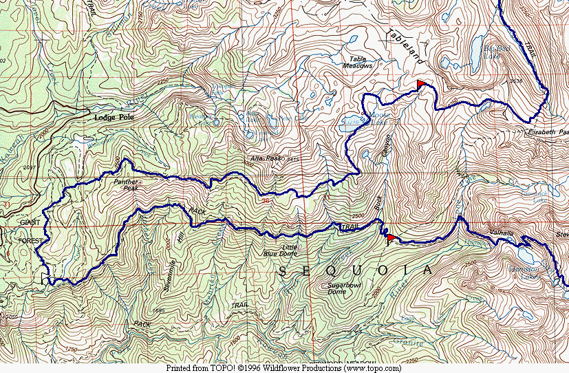
Map 1 -- Wolverton to Hamilton Lake
You can jump directly to points in the trip by clicking on the maps
above.
You can click on any of the photos to see a larger version, uncropped and uncorrected.
You can download the TOPO! source file to see
more detail in the maps.
You can see the raw photos here.
|
|
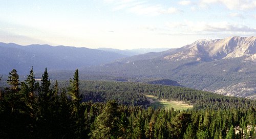
I started early at Crescent Meadow, getting on the trail well before sunrise to avoid
the heat. The walk to Bearpaw is pleasant -- almost level, shaded, with glimpses of
the valley off to the south. |
View across Kaweah River Valley from Bearpaw
Camp |
|
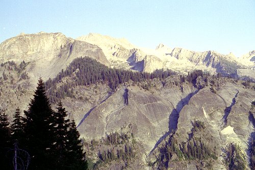
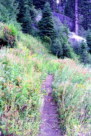
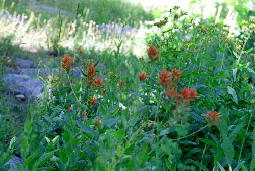
| The next morning I again got an early start from Bearpaw. I like to get away
before anyone else is out of bed. The wildflowers were spectacular this year.
I guess springtime is only a few weeks long, followed by a couple weeks of summer,
another few weeks of fall. It is a real treat to see all the flowers. |
|
|
Trail above Bearpaw |
Map 2 -- Hamilton Lake to Kaweah Basin
|
|
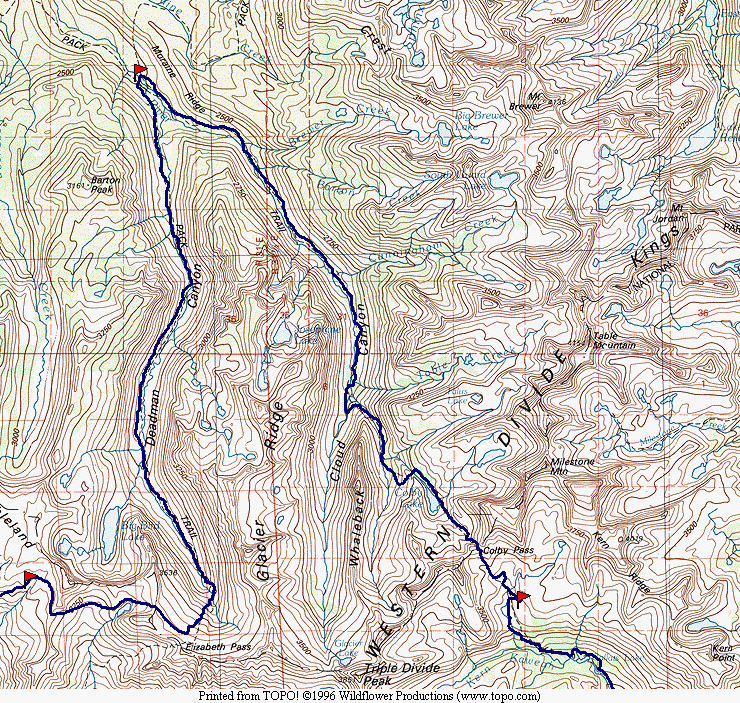
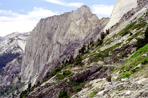
The real climbing starts after Bearpaw. I was almost to Hamilton lake before I
got into direct sun. Here Angle Wings is gleaming white in the sunlight, while I am
still in shadow. |
| Angel Wings |
|
| I passed Hamilton Lake just as most of the people there were eating breakfast.
In the hot sun and with the trail steepening, I was definitely slowing down. |
|
|
Hamilton Lake |
|
|
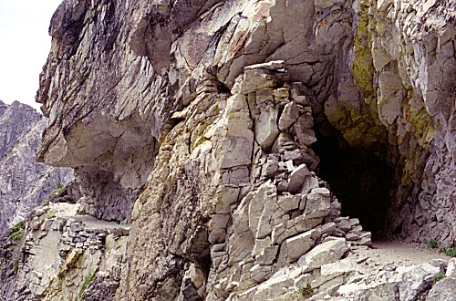
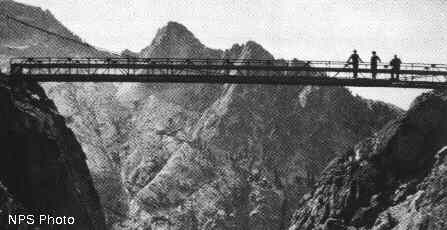
Above Hamilton Lake the trail has to get around a really steeped canyon. At one
time, there was a suspension bridge across, but it was demolished by an avalanche in a
couple years. I snagged a picture showing what it used to
look like. It looked terrifying to cross. After that, the park service
built this great cutaway trail with a tunnel. |
| Trail above Hamilton Lake |
|
| After passing through the tunnel, the trail continues to ascend. Here is the
face of Angel Wings from higher up in the canyon. The side canyon with the tunnel is
between where the picture was taken and the trail visible in the center. |
|
|
Angel Wings and trail |
|
|
The trail continues to ascend past a series of lakes, up above the tree line. |
| Between Hamilton and Precipice Lake |
|
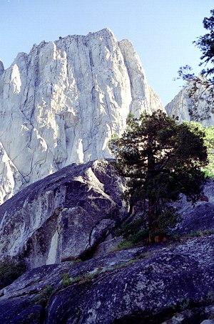
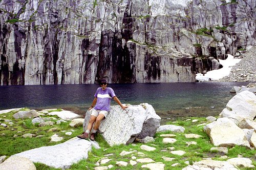
| The most picturesque of these lakes is Precipice Lake. The lake is surrounded by
cliffs, a small part of which is shown here. I had another party snap my picture. I
spent the night near one of the lakes in Nine Lakes Basin. I did not see anyone in
the vicinity. The party that I had met at Precipice Lake was headed for Big Arroyo
Junction, and I never saw them again. |
|
|
Precipice Lake |
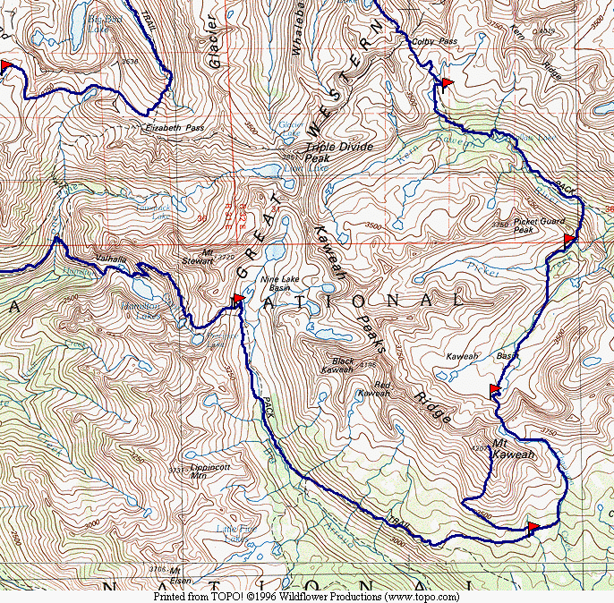
Map 3 -- Kaweah Peak and Kaweah Pass
|
|
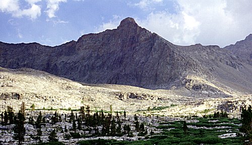
I was still feeling very strong, and made great time in Big Arroyo towards Chagoopa
Plateau. I got to the plateau at about lunch time, well ahead of schedule. I
ate lunch at the dry lake, and then took off on my own, trying to maintain elevation as I
contoured around the south slope of the mountain. |
| Mt. Kaweah |
|
| I camped at a wet meadow just west of Chagoopa Creek. It was a nice place to
stop, one of the few places with a water supply. Unfortunately there were plenty of
mosquitoes. I spent the afternoon napping and resting up. |
|
|
Campsite South of Mt. Kaweah |
|
|
The meadow was just about at treeline, at the junction of the slopes of Mt. Kaweah and
Chagoopa Plateau. |
| Campsite South of Mt. Kaweah |
|
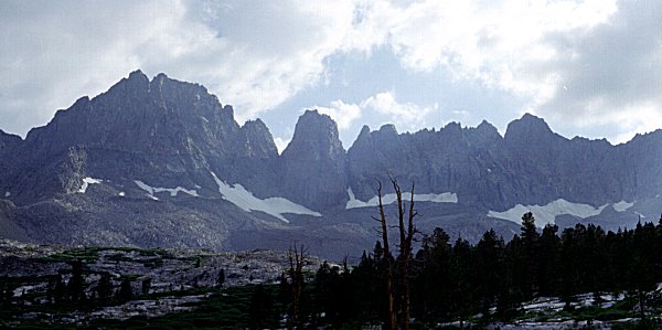
| The next morning brought clouds. I decided to see how far up Mt. Kaweah I could
get. The sun breaking through the clouds make for dramatic scenery. This was
taken at the upper boundary of the treeline on the south slopes of Mt. Kaweah. The
view is across Big Arroyo to the mountains in the Mineral King area -- Sawtooth, Eisen,
Lippencot, etc. Black Rock Pass is there somewhere. |
|
|
Slope of Mt Kaweah -- Looking Southwest |
|
|
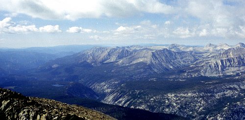
This picture, taken from about the same vantage point as the last one, shows the
gentle slopes of Chagoopa Plateau, and behind it Big Arroyo (right-center) and the Kern
(left) |
| Chagoopa Plateau |
|
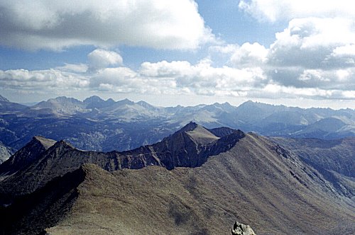
| The south side of the Kaweah Peaks Ridge is hard granite, light, yellowish,
decomposing into sandy slopes that are tiring but pose little technical challenge.
The north side is highly colored and much steeper. This picture, looking west along
the ridgeline, shows the contrast. |
|
|
Kaweah Peaks Ridge |
|
|
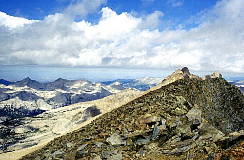
From the top of the ridgeline, Chagoopa Plateau is clearly visible. Across Big
Arroyo is the Great Western Divide. |
| Chagoopa Plateau and Big Arroyo |
|
| Looking east from Mt. Kaweah is Red Spur. It almost looks like volcanic rock
from this vantage point. |
|
|
East Ridge of Kaweahs |
|
|
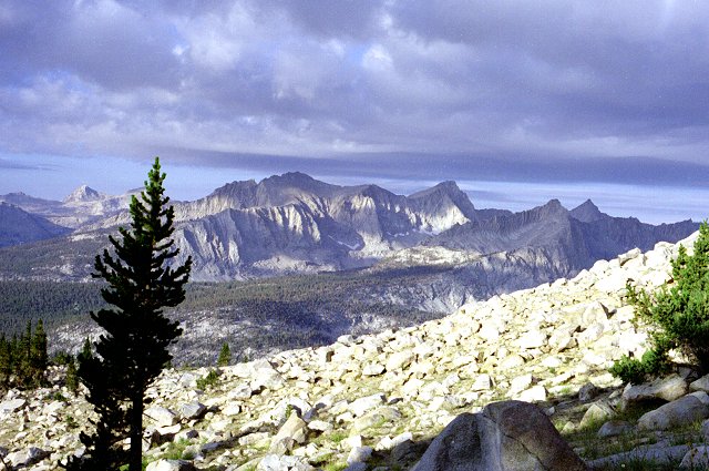
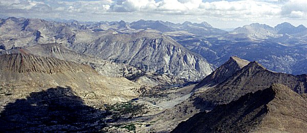
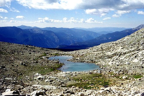
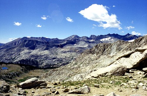
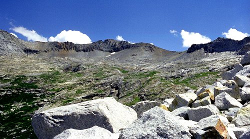
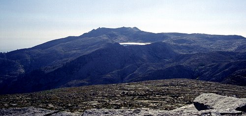
A little farther to the north from red Spur is the Kaweah Basin itself. This
shows the eastern half of Kaweah Basin, which is divided by Pickett Ridge, the second
ridge in the center-left, the one with a red stain showing. The ridge in front of it
extends from Kaweah Queen. Between the two lies Pickett Creek. I study this
view because I am aiming to cross the first ridge into the basin of Pickett Creek, from
where I will exit Kaweah Basin. I decide that the gap in the ridge, just about in
the center of the picture, looks like a good place to cross. |
| Kaweah Basin from Mt. Kaweah |
|
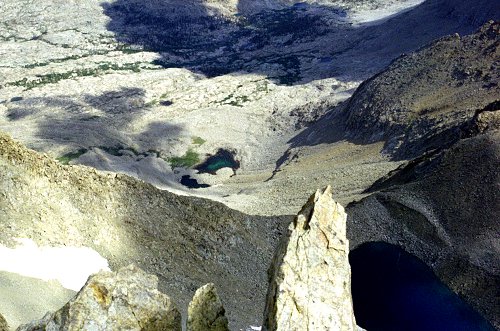
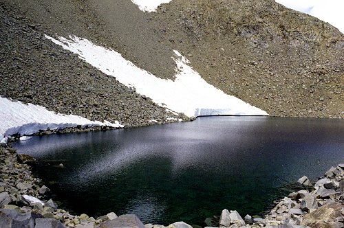
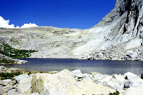
| From the top of Mt. Kaweah, I also study Kaweah Pass, which I will be descending
tomorrow. This view is looking essentially straight down. the big lake on the
right is 1200 feet below, at the top of the pass. The smaller lake in the center is
another 1000 feet below that, and is at the foot of the pass. Note the two
sets of cliffs protecting the lake. The bottom cliffs are not visible from the pass
or on the route down, not until you get to the immediate vicinity. |
|
|
Kaweah Pass and Upper Kaweah Basin |
|
|
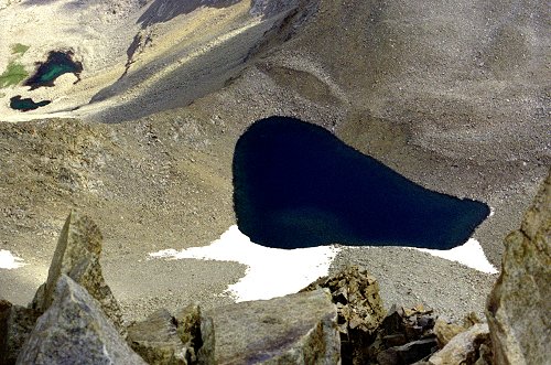
Here is another view of the lake and of the pass to its left. After
descending, I spent the rest of the day resting. I had no trouble finding where I
had camped, because I had made careful mental notes on the landmarks along the way. When I retraced this route in 1997, I had
access to an altimeter which made it much harder to get back to camp. |
| Kaweah Pass from Mt. Kaweah |
|
|
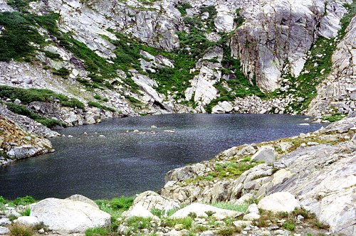
The next morning I pushed on to Chagoopa Creek, and followed it up toward Kaweah Pass.
There were a series of charming lakes along the way, forming stairsteps -- flat
areas interspersed with steep climbs. |
| Route to Kaweah Pass |
|
| As I reached the lake near the top of the pass, the nature of the rock changed
markedly. The monolithic blocks of decomposing granite were replaced by more brittle
chunks of dark rock, which were hard to walk on and which would shift underfoot.
Getting around the lake was an unpleasant, exhausting exercise. |
|
|
Lake near Kaweah Pass |
|
|
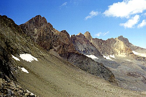
Once I got to the pass, I was rewarded with the view of the Kaweah Peaks Ridge from
the other (north) side. As I said earlier, this side is highly colored, steep,
fractured rock remarkably different from the opposite slopes. |
| Northern Slope and the Kaweahs |
|
| The descent of Kaweah Pass was scary, in part because the rock was so steep and so
loose. The highest part, the cliff just below the pass, was exceptionally steep and
scary. This picture shows the route I took. From the lowest part of the pass,
I descended just slightly to the left of center, to the left of the snow patch in the
center. I came directly down the slope from there until I reached the second set of
cliffs, which can be seen at the left here, and which are shown from below in the next
picture. I skirted around the top of the cliffs, looking for a way to descend.
I did not find one, but instead came all the way around to the lake pictured here.
From this lake, I was able to descend further. |
|
|
Kaweah Pass from Kaweah Basin |
|
|
This shows the lower part of the descent of Kaweah Pass, the second (lower) set of
cliffs. I crossed from left to right at the top of the cliffs, eventually avoiding
them entirely. |
| Kaweah Pass -- Lower Route |
|
| The weather was threatening rain, so I stopped at the first level spot and set up my
tent. It only rained a few minutes, but the clouds were blowing over the ridge all
afternoon. |
|
|
Kaweah Peaks Ridge |
|
|
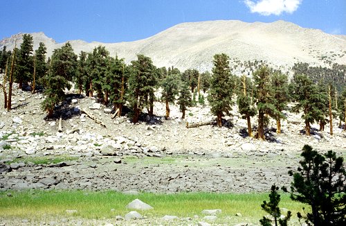
The next day I explored the upper part of Kaweah Basin before heading on down.
Most of Kaweah Basin is above the tree line, and seems wild and remote, just what I had
been expecting. I saw few signs of trails, ducks, or previous visitation. This is
Red Kaweah, another peak on the ridge. |
| Red Kaweah |
|
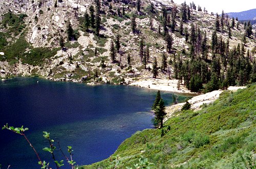
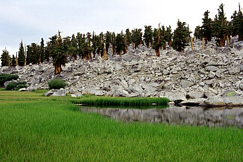
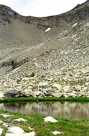
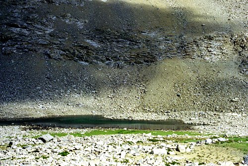
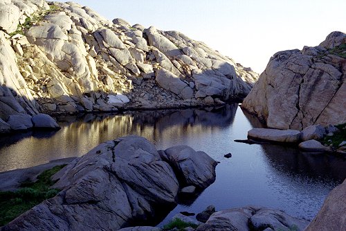
| I crossed into Picket Creek basin without difficulty, and descended to the edge of the
drop-off. This lake is perched right beside a big cliff: the mountainside in the
background is on the other side of a valley that drops 500 feet just beyond the trees
nearby. I camped near the lake so that I could scout out ways to get down into
the valley. |
|
|
Lower Kaweah Basin |
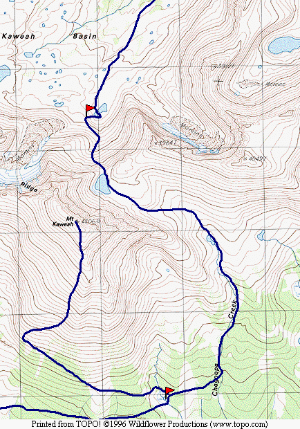
Map 4 -- Lower Kaweah Basin
|
|
It turned out that the drop into the basin of the Kern-Kaweah was not as challenging
as I had expected. I veered west diagonally across the slope, and never encountered
the steep cliffs I saw on the map. I was relieved to be back on a trail again, and
cruised right up to the vicinity of Colby Pass. I took a detour off the trail,
staying the night at a little lake on a bench above the canyon floor (shown at the left of
the picture here).
This picture also shows the Kaweah Peaks and the Kaweah Basin. |
Upper Kern-Kaweah
From near Colby Pass |
|
| Crossing Colby Pass, I came to Colby Lake about midday. I was enjoying hiking on
the trail: although sometimes I love getting away from it and exploring remote areas, at
other times the stress and worry take away from the pleasure. I guess the descent
from Kaweah Pass left its mark on my psyche. I needed to get to Crescent Meadow in four
days, and there were several options. The shortest way would be to cross Coppermine
Pass, Elizabeth Pass, and hike back from Bearpaw. Alternatively, I could head down
Cloud Canyon to Roaring River and go back via Silliman Pass.
I decided to stay on the trail at this point, and to head to Roaring River. It
was pleasant to be going downhill on a good trail. I reached Roaring River having
met no one on the trail since Precipice Lake.
I decided to return Via Deadman Canyon and the Tablelands. To get a headstart on
the next day's ascent, I started up that afternoon, camping in a little hidden area next
to the stream. |
|
|
Colby Lake |
|
|
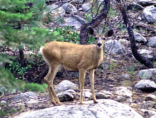
I spotted much wildlife in Deadman Canyon that day. |
| Deer
in Deadman Canyon |
|
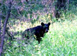
| I saw this bear
cub, took a picture, and discovered that I needed to reload the film. While I was
doing so, two more cubs and an adult showed up. I backed off and let them pass. |
|
|
Deadman Canyon |
|
|
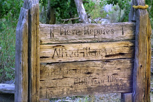
Here is the grave that gives Deadman Canyon its name. |
| Grave Marker in Deadman Canyon |
|
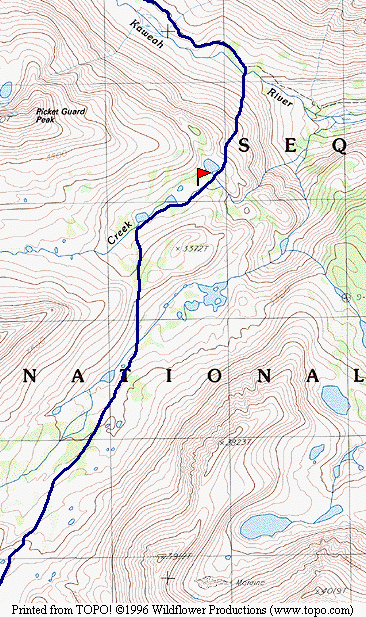
Map 5 -- Kaweah Basin to Tablelands
|
|
I made excellent time up Deadman Canyon, reaching the vicinity of Elizabeth Pass
shortly after noon. I climbed to the head of the bowl and turned off toward Lonely
Lake. This picture was taken from that vicinity, showing the Coppermine Pass route
(the colored rocks on the ridgeline to the left). The copper mine is on the ridge
line about in the center, and Elizabeth Pass is off the picture to the right. |
| Coppermine Pass Route |
|
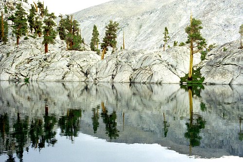
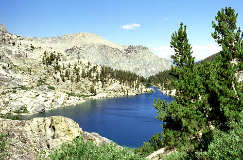
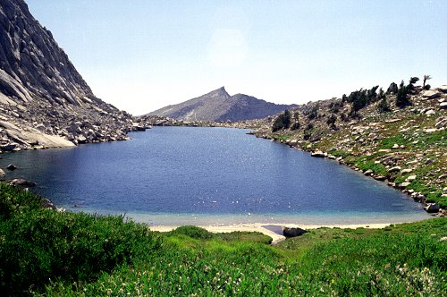
| Lonely Lake, as always, was stunningly beautiful. I took a quick dip in the cold
water on the beach, before heading around to camp at the other end of the lake. |
|
|
Lonely Lake |
|
|
Looking back along Lonely Lake, you can see the pass into Deadman Canyon and the route
down the huge rock slabs. Clouds continued to well up behind the ridgeline all
afternoon, but I continued to have clear weather on my side. |
| Route to Lonely Lake |
|
| The view west from Lonely Lake encompasses most of the Tablelands, and the area
beyond. The lake in this picture is Moose Lake, with Alta Peak behind. |
|
|
Moose Lake from Lonely Lake |
|
|
The next day I crossed Pterodactyl Pass into the Tablelands. I wandered around,
exploring various sights as the spirit moved me. In the late afternoon I came across
this picturesque little lake, and decided it was a good place to stop for the day. |
| Campsite in Tablelands |
|
| I took my last look at the Kaweah Peaks Ridge from this vantage point. |
|
|
Last View -- Kaweah Peaks |
|
|
The next day I headed for Moose Lake, arriving before noon. I filled up my
water bottle, and headed for the Alta Meadow trail. I had never been on this route
before, but the map showed a trail, so I thought it would be easy. It would have
been, too, if I had been able to follow the route. But no matter how hard I tried, I
could not figure out the proper route. I constantly found myself fighting through
thick brush, reaching steep drop-offs, retracing my steps. Eventually I reached Alta
Meadow, still searching for the trail. |
| Alta Meadow |
|
| Back into springtime and pretty wildflowers, my heart sang. Eventually I found
the trail and started making good time downhill. |
|
|
Alta Meadow |
|
|
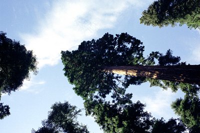
It wasn't long before I was back among trees, then into the Sequoia groves near
Crescent Meadow. I started seeing people finally, just a couple miles from the
trailhead. Even though I had passed through Roaring River, I had not met another
person for over a week. |
| Giant Sequoias in Crescent Meadow |
|
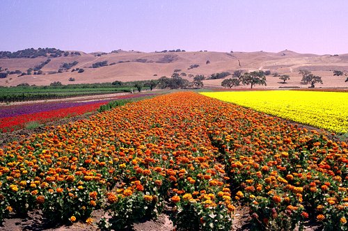
| This is not in the Sierras, but I saw it on my drive back from the trip. It is
apparently a flower farm near Gilroy. It went on and on, and was so beautiful I had
to stop and take a picture. |
|
|
Flower Farms |
 Go
back to Charles Hayden's Home Page
Go
back to Charles Hayden's Home Page
cchayden@gmail.com