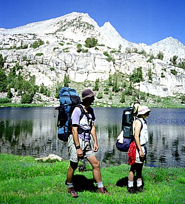
Trip Report Gardiner Basin July 21 - 31 1996
The hard rain pelting the tent woke me up. I glanced at my watch: 12:30 AM. Will this
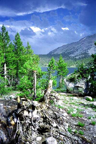
rain ever stop ? We were camped on a rock outcrop overlooking a lake at 11,000 feet in
Gardiner Basin, in Kings Canyon National Park. It had been raining since noon. Roy, Eva,
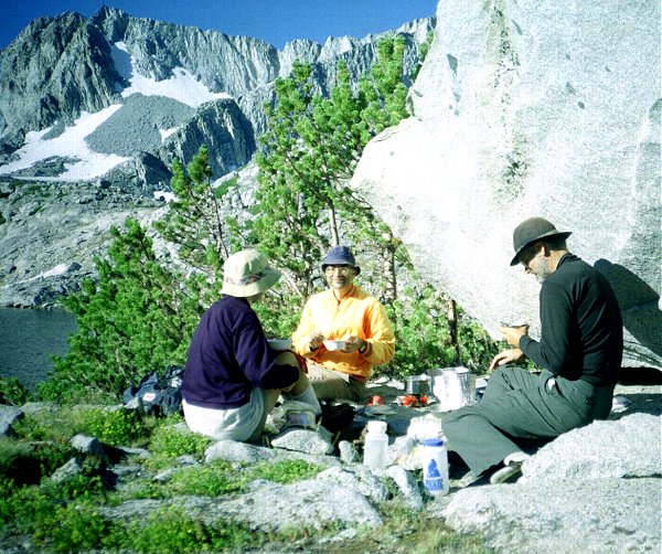
and I had spent most of the afternoon in our tents. We huddled under a rock to cook
dinner, then retired back to our tents. I found that the rainwater, running over the rocks
and under my tent, had wetted my tent floor and soaked a large part of my sleeping bag. A
steady breeze was making the fifty-five degree air feel much colder. I had been sure the
rain would stop at nightfall.
As I lay there after midnight, my mind went over the alternatives. We had planned to
climb Mt. Cotter the next day, but that would be impossible on wet, slippery rock. If it
kept raining, we could not even get out of Gardiner Basin, which involved climbing up over
steep, rocky, trailless slopes. Could we stand to wait in our tents for the rain to end ?
The weather had been getting cloudier, the rain had lasted longer, every day for the past
week. How much longer could it go on ? If we were forced to wait an extra day, how could
we make it up ? On and on my mind spun.
I opened my eyes, and the tent seemed to be glowing. My watch read 1:30. I listened to
the tent fly flapping in the wind, but I no longer heard the sound of rain. I opened the
tent door and saw the full moon poking through a hole in the clouds, illuminating the
cliffs around us as well as the clouds above. The thick overcast sky of the previous days
had turned patchy - I could even see stars through other holes in the clouds.
I closed my eyes for a moment and it was 2:30; stars shone across the entire sky. The
moon had set behind some neighboring cliffs, but was illuminating Mt. Cotter, which seemed
to be glowing a ghostly white. The mountain looked more like it I had been covered in a
dusting of snow. Maybe the weather pattern had changed for good. I settled down to sleep
and the next thing I knew the sun was rising over a brilliant blue, cloudless sky.
But let me start from the beginning...
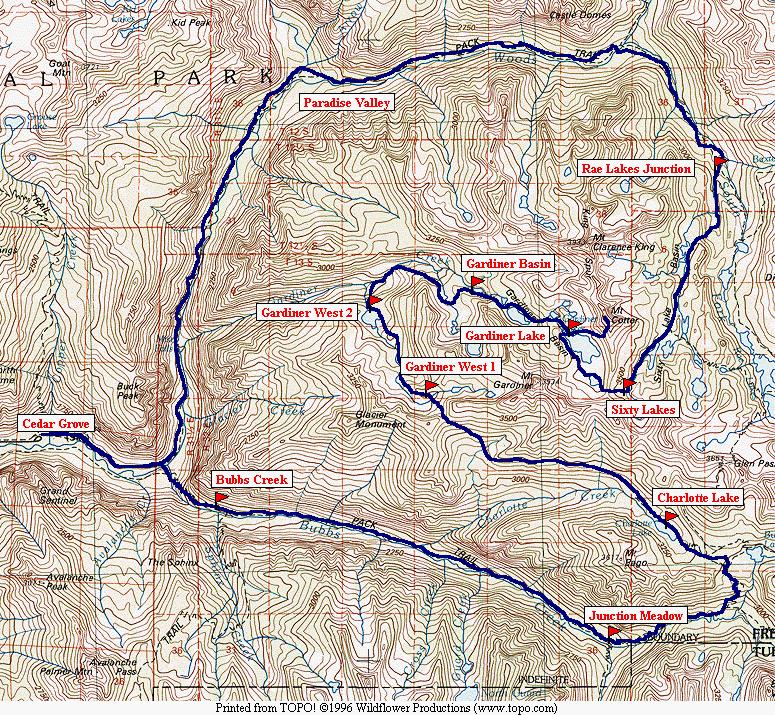
You can jump directly to points in the trip by clicking on the map above.
You can download the TOPO! source file to see
more detail in the maps.
You can see the raw photos here.
July 22 -- Junction Meadow
We left home yesterday at 5:00 AM for Newark airport. The flight went smoothly,
arriving in San Francisco ahead of schedule. We even caught an earlier flight Fresno.
Unfortunately our baggage did not make it out with us, so we had to wait for it at Fresno.
In the meantime, we got our car, bought fuel, and were all set to go the minute our
baggage arrived. Foiled again ! One of our bags fell of the baggage cart on the runway and
it took us half an hour to spot it and call it to the attention of the baggage handlers.
So we were the last ones out of the airport. My major concern, the stoves and fuel
bottles, made it through. The agent in Newark inspected them but let them go on.
Since we planned to hike in the first day, we made arrangements to pick up our
wilderness permit at Grant Grove in Sequoia, rather than at the trailhead. This gave us a
chance to interact with the "road" rangers rather than the
"backcountry" rangers. While I was picking up my permit, the visitor next to me
was asking the ranger "Where is Old Faithful ?" The ranger replied, with a
straight face, "In Yellowstone National Park." The visitor then asked
"Isn't this Yellowstone ? Well, how do I get there ?" The ranger, acting like
this was the umpteenth time he had had this conversation, said "In Wyoming. Do you
want me to get out a US map ?" So he got out the map, showed the visitor where
Yellowstone was, gave him detailed driving directions, and answered several other
questions about Old Faithful. The visitor appeared headed right for Wyoming.
Meanwhile, the ranger handling my backcountry permit had no idea where we planned to
go, and did not even fill out his own copy of the permit with our itinerary. He gave us
some misinformation about the snowline, and we were off.
|
|
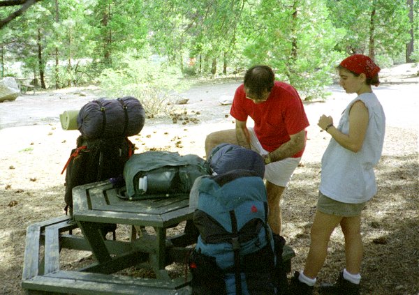
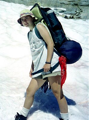
At Cedar Grove we stopped at the snack bar to get got drinks and ice cream. It was 107
degrees in Fresno, and only about 15 degrees cooler in Cedar Grove. We repacked all our
luggage and drove on to the trailhead, ready to go by 5:00 PM. |
Repacking at Cedar Grove |
|
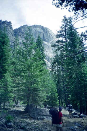
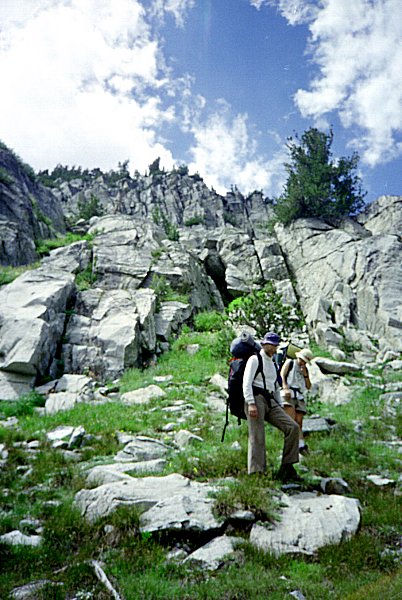
| The first part of the trail was on the broad, flat, valley floor. The trail was sandy
and wide, with walls towering over us on both sides, thousands of feet high. After two
miles we crossed Bubbs Creek, and then headed up two miles of switchbacks. The weather was
hot and dry, with little shade. By 7:00 PM we arrived at our first night's destination,
Sphinx Creek Junction. Even though it is the closest camping spot on one of the most
heavily used trails in Sequoia/Kings Canyon, there were only two other parties there. We
had plenty of time to make dinner and set up the tents before it started to get dark.
There were a few mosquitoes when I went to bed, so I put up the tent. I woke up an hour
later and found the mosquitoes had disappeared, so I left the door open the rest of the
night. I was pleasantly surprised at how well I slept - usually the combination of
exhaustion, altitude, jet lag, sleeping on the ground, excitement, and worry wake me up
every half hour the first two nights, at least. |
|
|
Bubbs Creek trail below high valley walls |
This next morning was bright and clear. We all stayed in bed
for an hour after sunrise, dozing. This is indication that everyone was comfortable the
first night. Despite dallying, we were ready to leave by 8:30 AM, before either of the
other parties was even out of their sleeping bags. The plan was to hike seven miles,
ascending 2000 feet along Bubbs Creek. Before long the weather turned hot, but Roy and Eva
kept up a fast pace. I trailed most of the way. We reached Junction Meadow, our planned
destination by 12:30 PM.
|
|
We saw several small parties headed the other way, but no one going our direction. We
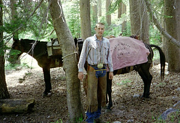
set up camp at Junction Meadow, ate lunch, and took a snooze. While we were napping, a
packer arrived and dumped a big pile of equipment in the campsite next to ours. Some time
later, a group of people showed up to claim it, carrying only day packs. We saw a couple
other parties, probably including those camped at Sphynx Creek Junction last night. They
all went on past us, toward Vidette Meadow. After thinking it over, we decided to stay the
night at Junction Meadow for the night. |
Packer at Junction Meadow |
|
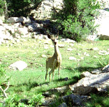
| So far we have seen: a 3 foot long black snake with yellow strips along its body;
several deer less than 10 feet away; many varieties of flowers; lots of blackberries;
hundreds of lizards; and numerous squirrels and chipmunks. A party we met on the trail
today had camped in our spot right here, last night. They warned us that they had seen a
rattlesnake in camp. Indeed, on close examination, there are dozens of small holes all
around the campsite - under almost every rock and tree in sight. However, we have not seen
the snake yet. |
|
|
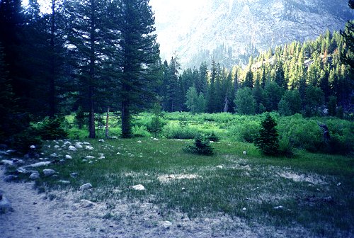
Junction Meadow |
|
|
All around us the walls tower thousands of feet above us. It is too intimidating to
think we will be climbing all that way in the next couple days, so we just admire them.
The walls are extremely steep and end with enormous cliffs at the top. William Brewer
explored this canyon in 1984, and was preoccupied with finding his way over the passes to
the East. No wonder he was worried -- it looks like we are walled in. Interestingly, when
Brewer camped here, he saw numerous rattlesnakes. |
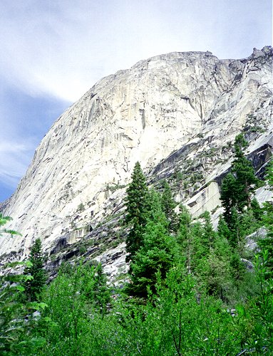
Charlotte Dome from Bubbs Creek Trail |
|
July 23 -- Charlotte Lake
The night was warm again. I tried going to bed without a tent. As soon as the sun went
down the bugs came out, so I had to put the tent up. Again, we all had a good night's
sleep.
|
|
We got an early start this morning: 7:30 AM. As before, it soon got hot. The trail
gets steeper and steeper as it moves farther up the canyon, which is typical in the Sierra
Nevada. As it gets higher, shade gets less and less frequent. Roy and Eva hike faster than
I do, but rest more often, so I just about keep up with them. We were going to stop and
rest at Vidette Meadows, but the mosquitoes were so thick we had to practically run past
it. The parties that had passed us the day before had evidently stopped there, although I
don't see how they could have stood it. |
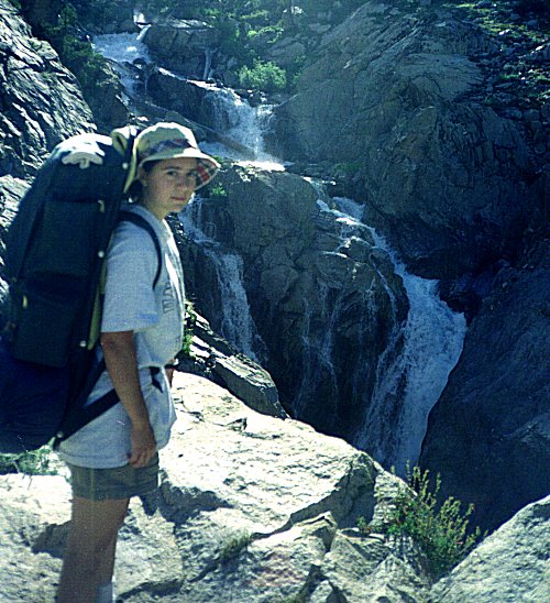
Eva beside stepening Bubbs Creek |
|
| After Vidette Meadow, we left the valley floor and switchbacked up the canyon wall.
The Bubbs creek trail continues up toward Forrester Pass to the south, but the segment we
followed leads to the John Muir Trail and the Rae Lakes loop, so we were still on one of
the main thoroughfares of the park. Even so, we saw no hikers past Vidette Meadow. We made
good time up the trail and arrived at Charlotte Lake by noon. No one was there when we
arrived, but a the Charlotte Lake ranger, and a trail crew returned to their campsites
nearby later in the day. |
|
|
Bubbs Creek from Charlotte Lake Trail |
|
|
We asked the Charlotte Lake ranger about our plan to cross Gardiner Pass and King Col.
The ranger had been to Gardiner Pass, but not beyond. By this time we could already see
that there was no snow on the pass - something we had been worried about. She was dubious
about our plan to go over King Col - she had never heard of anyone doing that. Later she
got on the radio and consulted with the Rae Lake ranger who agreed that King Col would be
dicy. She tried to reach the Bench Lake ranger to ask him, but he had not responded to his
radio for the past three days. She told us to check in with him when we passed, and to let
him know what we found on King Col. |
Charlotte Lake Gardiner Pass on
horizon |
|
| After resting for a couple hours at Charlotte Lake, I set off to climb Mt. Bago. The
map makes it look almost trivial, but it was steeper than it looks. About half way up, it
started to rain. I waited under a tree for a while, yet it just rained harder and harder,
so I retreated. It wound up raining for two hours. The rain stopped just at dinner time,
so we did not have to cook in the rain. But the mosquitoes came out again at sundown, so
we all headed back into the tents. My feet - a traditional worry - are doing
great. I have a tiny blister on my heel, which formed a couple of days ago, but it is
holding steady. Roy has an ugly blister on his big toe, probably a result of his new
boots. Eva's feet are fine. So far, a trouble-free trip.
William Brewer passed by Charlotte Lake on his way up Bubbs Creek to Kearsarge Pass.
The main peaks in Gardiner Basin, Mt. Gardiner, Mt. Cotter, and Mt. King, are all named
after members of his expedition. Mt. Brewer is across Bubbs Creek to the south a few
miles. |
|
|
Charlotte Lake from slopes of Mt. Bago
|
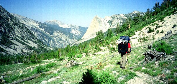
July 24 -- West Fork Gardiner Creek
|
|
We got an early start again from Charlotte Lake. From here on there is no regular
trail. We were able to follow faint signs of an old trail in most places. If we had tried
harder we could probably have found more of it, but the general direction was clear and
hiking conditions were good. As the path left the canyon floor, the convenience of a trail
was more and more pronounced. Eva and Roy again led most of the way. The trail drops
significantly until it gets to a sort of a junction high up on the valley wall, where it
meets another faint trail, apparently one up Charlotte Creek. Then it climbs upward into
the bowl below Gardiner Pass. |
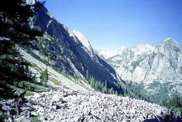
Charlotte Dome (center) and Gardiner Pass
(right) |
|
We stopped for a rest and a drink of water there, and scouted around for signs of the
trail. The climb up to Gardiner Pass is very steep, despite the "switchbacks."
We climbed most of the way up before finding the trail, but it was good to know it was in
the vicinity, and that we were crossing the right pass. There are several potential points
on the ridgeline that might be the pass, at least from the Charlotte Creek side. The
correct one is to the right and slightly higher than the low point. On the Gardiner Basin
side there is only one spot without huge cliffs, so it is essential to cross at the pass.
| We were all glad to get to the pass - we were drenched in sweat and very thirsty.
There was a breeze at the top, and spectacular views in both directions. To the south is
Bubbs Creek, and beyond that Mt. Brewer and its environs. To the north is Gardiner Basin,
Gardiner Creek, and Paradise Valley. |
|
|
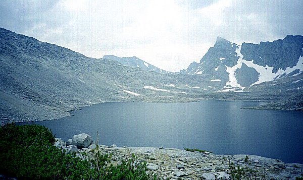
West Fork Gardiner Basin from
Gardiner Pass |
|
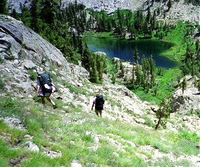
|
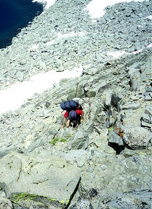
The north side of the pass is much steeper than the south, and the nagging concern
over how we were going to get down occupied our minds as we rested and snacked up above.
The first 40 feet were straight down. There may have been a way to bypass this section by
going up the ridge to the east, but I found a rock-choked crack and descended it like a
ladder. I think it gave Roy second thoughts, but we all made it down safely. |
Descending North side of Gardiner Pass
|
|
| The next thousand feet or so were very steep and rocky, but not vertical. It looked
like every approaching cliff would be impassable, but I kept finding signs of a path, so I
knew were heading in the right direction. We aimed for the closest lake in the upper
valley, and arrived just before noon. The north side of the pass held the first patches of
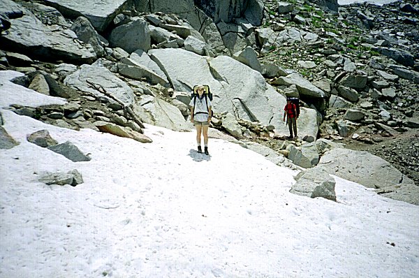
snow we had come across, but we had no difficulty crossing or bypassing them. |
|
|
Below Gardiner Pass |
| Even though we were among snow patches, just under 11,000 feet, the water in the lake
was surprisingly warm (only frigid). I swam out to an island in the lake, turned around,
and swam right back. The sun was still ferocious, so I was dried off in less than half an
hour. I tried to stay covered up so that I would not burn, and succeeded in only burning
my feet between the sandal straps. Later both Roy and Eva went swimming, and we all rinsed
out our dusty clothing. We generally lounged around camp, recovering from the steep
descent, admiring the spectacular scenery and wonderful views, exploring the surrounding
lakes. |
|
|
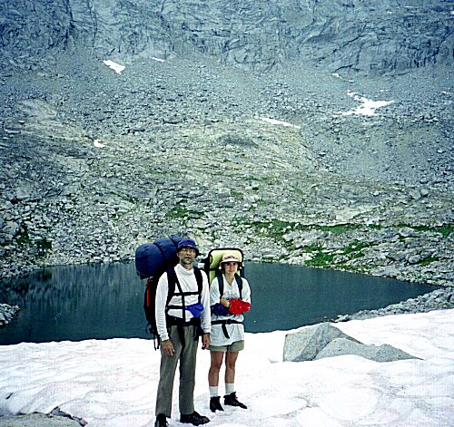
Charlie on island -- West fork Gardiner
Basin |
|
|
To keep on schedule to cross King Col and head up Arrow Canyon we would have to
descend most of the way down Gardiner Basin today. If I were hiking alone, that is
probably what I would do. But Roy and Eva are content to stay put, and after some thought
I realized that Gardiner Basin is probably as scenic and remote as Arrow Canyon, and we
were already here. So instead of hurrying through Gardiner Basin, we will make Gardiner
Basin the focus of the trip. This simultaneously relieved the schedule pressure, the
necessity to make it over King Col, and the long hiking days later in the week. Later
in the afternoon it became breezy and then cloudy. We could hear thunder all afternoon,
and lots of dark, threatening clouds swirled around us. It never did rain on us though.
And there were no mosquitoes all day long. But as before, after dark the mosquitoes came
out, so we had to put up the tents and hide inside. I must have had forty on my screen
door ! |
North side of Gardiner Pass from campsite
|
|
July 25 -- West Fork Gardiner Creek
In the new spirit of taking it easier, we all slept in until the sun was upon us, ate
and packed in a more leisurely way, and got off at 9:30 AM. Our plan was to descend the
west fork of Gardiner Creek, to the big lake just above where it joins the east fork. We
did not see signs of the trail often, so we just wandered down from one lake to the next,
crossing and re-crossing the stream and dropping steadily. We had to negotiate downed
trees, brushy places, and swampy spots more and more as we descended. We finally had to
cross a shallow arm of a lake. I waded across with my boots on, getting them thoroughly
soaked, while Roy and Eva changed into their sandals. We were being harassed by mosquitoes
when we stopped, so we kept moving pretty steadily. I was growing increasingly concerned
that we find the trail, because the guidebook warns of an "incredibly steep"
descent beyond the big lake, and I wanted to find the trail for this descent. So I was
greatly relieved to find unmistakable signs of the trail starting its descent. Five
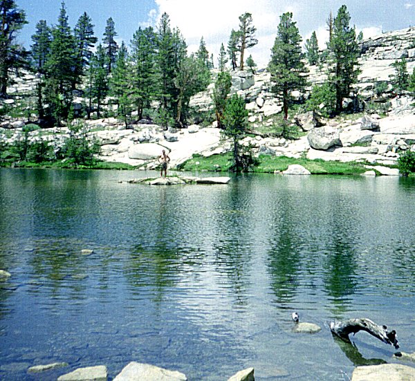
minutes later was the lake, and for the first time, no mosquitoes.
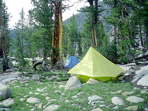
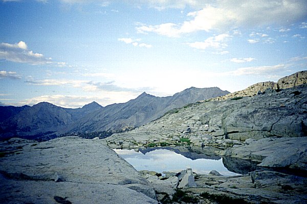
| We found a wonderful campsite, with great views of the lake, rocks piled into tables
and chairs, and good clear spots to sleep. I noticed, like at lakes further up the canyon,
that the obvious bear-hanging trees had lots of claw marks. I am surprised that there are
enough visitors to attract bears.
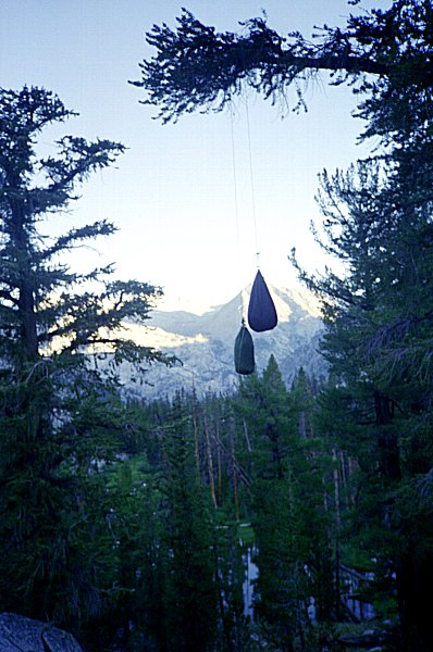
In any case, we hung our food in one of the clawed-up trees and never saw any bears.
|
|
|
West Fork Gardiner Creek --
Gardiner Pass on horizon |
I am finally able to relax, get out of the hurry-up mentality, and stop wondering when
we will get there. We are there. I think Roy and Eva achieved this several days
ago, but it always takes me a long time to slow down and adopt the pace of the trail. Roy
put up his hammock, and I lounged in it for a couple of hours, just observing the changes
in the lake and surroundings as the sun moved across the sky.
July 26 -- East Fork Gardiner Canyon
The day dawned with thin overcast clouds. Each day the clouds seem to form a little
earlier and get a little thicker.
We began hiking down the canyon wall toward the main fork of Gardiner Creek. It was
exceptionally steep, but not rocky or obstructed by cliffs, and we kept sight of a
rudimentary trail the whole way down. At the bottom, we had a much harder time finding the
trail. It was marked by little piles of rocks here and there, but these did not seem to
follow a better route than any other, and we kept losing track of them. We had been warned
that cliffs in the canyon floor would block our way, and that we should look for an
opportunity to climb part way up the canyon wall to bypass the cliffs.
|
|
This part of the canyon, like so many other canyons in the Sierra, has a profile,
looking up and down the canyon, like a series of stair steps. On the level places are
meadows or lakes, separated by cliffs, waterfalls, and large rocky monoliths. The canyon
in cross section is generally flat on the bottom with nearly vertical sides, above which
is a zone of broken rocks at the bottom of vertical cliffs near the ridges. The guidebook
advised up to get up to the zone of broken rocks beneath the cliffs and follow this up the
canyon. Soon an opportunity to get up presented itself. The trail seemed to be
headed in that direction, although it was hard to be sure. So we struggled up the canyon
wall and proceeded to pick our way through the rocks upward. It was nerve wracking because
it was impossible to see very far ahead, and I always had the fear that our way would be
blocked and we would have to retrace our steps. We kept on going, looking for a way back
down to the canyon floor without losing too much of the altitude we had gained. Finally we
could stand it no longer, and just decided to get directly down. There was a crack handy,
which we descended. by lowering our packs on ropes. We were much relieved to be back on
the more gentle lower slopes. |
Descending canyon wall in Gardiner Basin
|
|
| As we were reaching a good resting spot for lunch it began to rain, so we hung up the
food, broke out the tents, and got inside. The wind blew so hard I thought we might blow
away. I put everything I had inside the tent, and had to go out over and over to tighten
the lines, since they tend to stretch as they get wet. The storm ended a couple hours
later without really dropping much rain. |
|
|
Waiting out rain in Gardiner Basin |
|
|
Since we are already set up, we decided to stay for the night. We are in a stand of
trees between two small lakes. I did some exploration, and found some rock piles leading
up the canyon. As I followed them, I realized that we were not on the recommended route at
all, but in a side canyon. But the path leads over a nearby ridge into the
"correct" canyon. Since the map indicates more cliffs along the canyon floor, I
hope that we can do a better job of staying on the route tomorrow. |
Lakelet near campsite |
|
July 27 -- Gardiner Basin beneath Mt. Cotter
The weather at night has been unusually warm the whole trip, and last night was no
exception. Maybe it is the result of the overcast skies. About 4:30 AM the wind started to
blow, and a little rain fell, so I got up and put up the tent. By the time I was finished
the rain had stopped. Since Roy and Eva were already in their tent, I suspect they never
even woke up. The clouds this morning are thicker than ever, and it is cooler. We have not
had to deal with real hot weather since the day we crossed into Gardiner Basin.
|
|
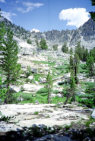
We resumed our climb up the east fork of Gardiner Creek, following markers where we
can find them. Eva is the best at spotting markers. We passed many large and small lakes,
passed above the treeline, and arrived at the biggest lake in all of Gardiner Basin at
noon. |
Gardiner Creek |
|
|
|
Roy and Eva in upper Gardiner Basin
|
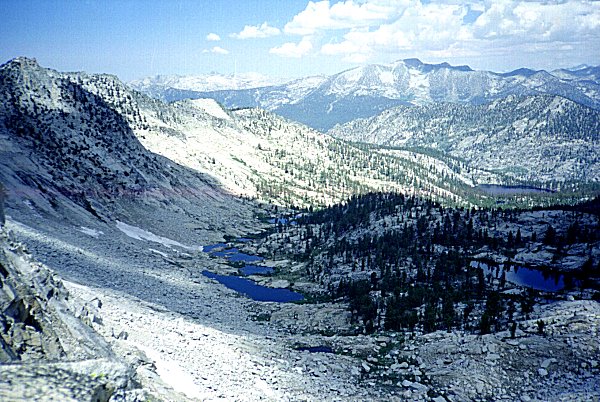
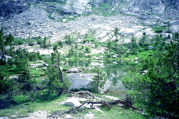
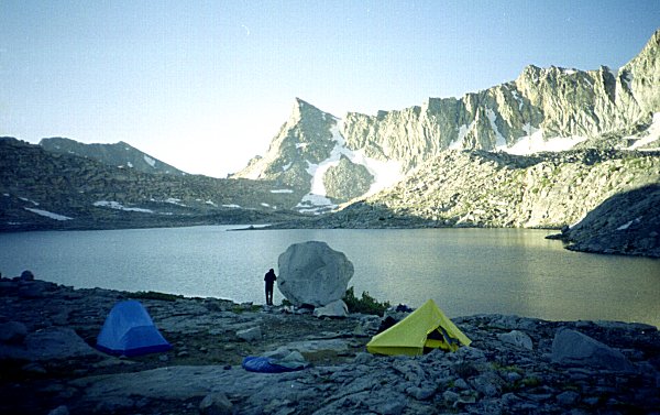
| The lake is surrounded by broken rocks, large slabs, and snow fields. We are camping
on a big flat spot near the mouth of the lake, near a giant boulder. Since there are no
trees, we have put our food on top of the boulder. The wind is blowing pretty steadily in
one direction, and strangely enough the only mosquitoes anywhere around are in the lee of
this boulder. They will bite if you go into their "space" but will not follow
when you leave. We only have to deal with them to get at our food - lower down beneath the
same rock, where we cook out of the wind, the mosquitoes keep to themselves above our
heads. |
|
|
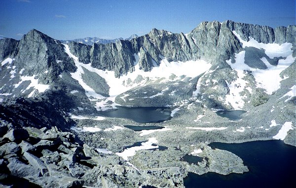
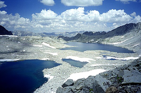
Big lake -- Upper Gardiner Basin
Sixty Lakes Col in center |
|
|
Campsite beneath Mt. Cotter East
flank of
Mt. Gardiner in center |
|
|
We are camped just beneath Mt. Cotter, an impressive needle-like peak visible to us
for days. When we first saw it, from Gardiner Pass, it looked impressive but impossible to
climb. Now I am thinking about seeing how far we can ascend it tomorrow. Since I had not
planned to climb any peaks in this area (we had not planned to be here at all) I did not
bring any information on the level of difficulty or the routes up the peak. From this
vantage it looks like we could traverse the southwest face to the south ridge, and then
follow this to the peak. The summit looks like a huge rectangular block with vertical
sides, so it might not be possible to get the last little bit up. The plan is to
leave the camp set up tomorrow, and to lounge around or climb as we feel motivated.
Meanwhile, thick black clouds continue to blow up the canyon towards us, hiding the
surroundings and causing a misty drizzle. |
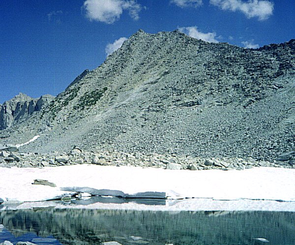
Mt. Cotter southwest face
(this picture taken July 29) |
|
July 28 -- Gardiner Basin beneath Mt. Cotter
Yesterday afternoon it continued to alternate between rain and drizzle all afternoon
and evening. Because the wind was still blowing steadily in one direction, our huge
boulder served not only as a wind screen but also kept us more or less out of the rain -
the only semi-dry spot around. It got colder and colder, and the tent floor got wetter and
wetter because it was pitched on solid rock (there is no soil around). I put on all the
clothing I had and was still cold, so I got out and walked around to generate a little
heat. When I got back to the tent sometime later, I found a big wet spot in my sleeping
bag.
As soon as I shut up the tent and got into my sleeping bag, I warmed up and even
started to dry out the bag. The tent makes all the difference in the world - it is so much
warmer inside when the door is closed and the wind cannot get in. The rain continued on
and off until after midnight, when it rained and blew especially hard and then suddenly
stopped. By 1:30 AM the moon was peaking through breaks in the clouds and by 2:30 AM the
clouds were breaking up and stars were showing through. Shortly, all traces of clouds had
disappeared. The moon was almost full, and it really lit up the night.
The morning was exceptionally clear, forty degrees. We took our time getting breakfast,
admiring the sites that had been hidden the afternoon before by clouds, and surveyed the
possible routes up Mt. Cotter. Everyone wants to give it a try.
|
|
The first part of the route goes around the lake and up the southwest face of the
mountain. We had a lot of boulder-hopping to do on the lower slopes, and then a steep,
hard snow field to cross. This was the most worrisome part of the route for me.Once we get
onto the mountain face itself we had to climb up piles of boulders, perched about as
steeply as they can be without rolling down the slope. Every now and then we pass through
a section of smaller stones and gravel, which slides down with every step. Finally we
reach the ridge, and can look over into Sixty Lakes basin. The view in both directions is
spectacular. |
Sixty Lakes Col (on left) and upper
Gardiner Basin
Mt. Gardiner to the right on horizon |
|
| When we were on the face, we had our nose to the rock, and did not have such a sense
of being high up. On the ridge it seems that all we see is sky in both directions. The
rocks on the ridge are larger and more stable, and the mountain faces on either side are
no steeper than before, so the climbing seems to me much easier and safer. Its effect on
Roy, however, is just the opposite. As we climb the ridge, we have to pass around one
"bump" after another. From camp (in the pictures) these bumps are hardly
noticeable, but up close they are twenty or thirty feet high blocks of solid rock. None of
them presents any real difficulty detouring around. |
|
|
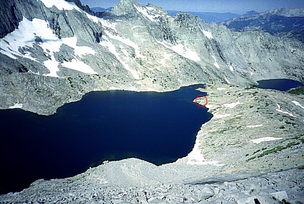
Looking down on the big lake
Campsite (circled) near outlet |
|
|
|
South ridge Mt. Cotter, Sixty Lakes Col
Sixty Lakes Basin
on left, Gardiner Basin on right |
|
Eventually we pass a buttress on the Sixty Lakes side of the ridge, and
thereafter the slope on that side is a sheer vertical drop of maybe 2000 feet. The large,
flat rocks on the ridge top themselves have not changed, but now I feel like Roy - I don't
want to be too close to the edge. We finish the climb by following just below the ridge
line so we don't have to look down the other side. The summit block turned out to be much
easier than it looked. The only challenge was facing that drop-off now on both the north
and east sides. Eva and I stuck our heads up over the highest rock, and peered over the
cliff while holding on to the surrounding rocks. Roy waited twenty feet below. We found a
brand-new summit register, placed there July 5 and signed by only one party before us. We
all signed the first page.
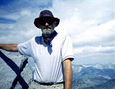
| Charlie on Mt. Cotter |
|
| Eva on Mt. Cotter |
|
We rested and admired the view from the top, until we noticed clouds
starting to build up below us. I was worried about getting caught in a storm on the
mountain, so we hurried down quickly. It took a little over an hour to descend what we had
spent most of the morning climbing. The clouds alternated all day between the white fluffy
kinds and dark menacing ones, but it never did rain. We spent the afternoon napping, doing
camp chores like repacking the food and fuel, taking pictures, and exploring the
surrounding territory. I realize that we are over the sore legs, blisters, and tiredness
of the first few days of the trip. The backpacks are getting lighter and lighter, we are
getting fitter and fitter, and the exhilaration of summiting makes everything today seem
worlds different from yesterday's discouragement.
|
|
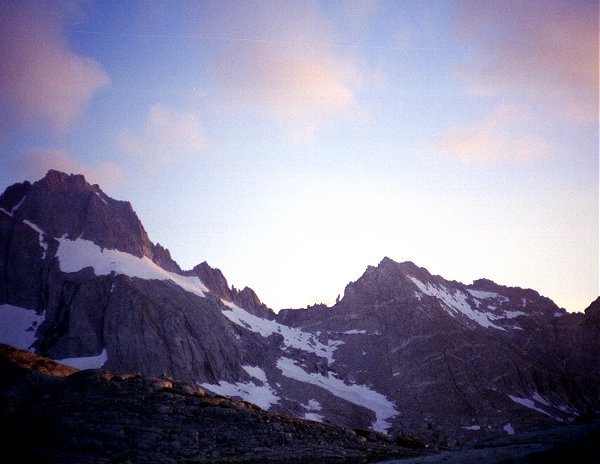
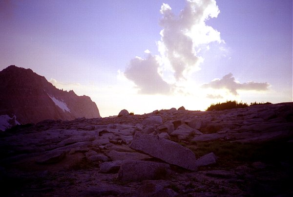
The evening was clear and the sunset was spectacular. Pink puffy clouds floated above,
while the ridges high above were silhouetted by the sky. The moon is almost full tonight,
and is visible already. |
| Campsite at sunset |
|
|
|
|
|
Sunset in upper Gardiner Basin |
July 29 -- Upper Sixty Lakes Basin
| Although I left the tent up, I slept outside last night. The moon was so bright I
could hardly sleep. I took some pictures by moonlight - I could not help it even though
they never turn out. Between moonset and sunrise I observed numerous satellites and a few
shooting stars. The Milky Way just does not seem as brilliant as I remember though. |
|
|
Preparing breakfast in upper Gardiner Basin
|
| Eva crossing This morning's route was around the lake and over the same ridge we
climbed yesterday. We were headed for a much lower spot on the ridge, and chose to go
around the lake the other way, for variety. Up above the largest lake are several others,
not visible from where we had camped. These higher lakes were ringed with snow fields,
stained a deep red from the algae. Most of the hiking was through fields of very large,
very sharp, boulders. It was a relief to cross snowfields, with their deep snow cups - it
was much easier than boulder-hopping. |
|
|
Eva Crossing snowfield |
|
|
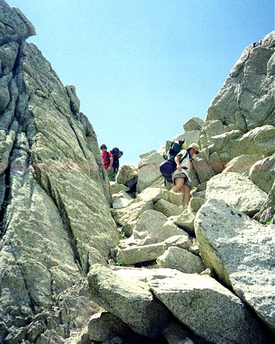
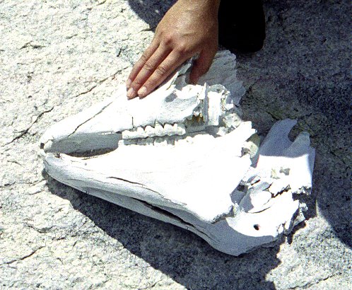
The last section over the ridge was unexpectedly steep. The Charlotte Lake ranger had
told us there was a route over the ridge, and that stock animals had supposedly been taken
over it. While we were reflecting on the implausibility of this, we stumbled across the
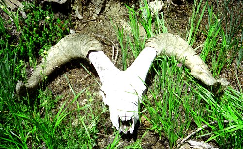
skull of some large animal. Was it a sheep, a deer, or the remains of a horse or mule that
could not cope with this route ? It had obviously been there for many years, because it
was chalky and bleached. Many other bone fragments were in the immediate vicinity. |
What is this ? |
|
|
|
Ascending Sixty Lakes Col |
| Finally we got up to the ridge and over into Sixty Lakes basin. As we were descending,
we came across a group of four big-horn sheep. They moved across the uneven ground so
gracefully, almost as if they were floating above the rocks. I snapped a few pictures. I
hope they show them - the sheep were exactly the same color as the rock and the camera
lens made them seem farther away than they really were. [Note: The pictures turned out,
but none of us can find the sheep in them.] |
|
|
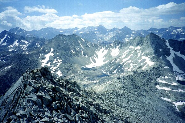
Gardiner Basin from Sixty Lakes Col
Lower slopes of Mt. Cotter on right |
|
|
As soon as we found a flat place to rest and eat lunch, the clouds began to form. In a
few minutes it was hailing. The hail was the size of peas. As usual, Roy had put his tent
up as soon as the weather threatened, and I waited until the last minute. I think I
finally got my tent set up just as the hail tapered off into steady rain. |
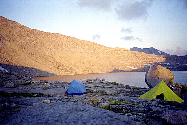
Campsite in Sixty Lakes Basin |
|
We had searched and searched for a flat spot to camp, and had to make do with a
marginal spot, perched on a rocky ledge (actually the two tents are on two successive
ledges). Again the tent is set up on rock, and again there is a stream running under the
tent floor, getting the sleeping bag wet. Rain continued most of the afternoon, with
thunder booming and echoing through the mountains like far-away bowling pins.
| The rain stopped just before dinner time, although a cold wind continued to blow. We
were all cold, so we set out to explore the surrounding lakes and streams. On this side of
the ridge, as on the other, the higher lakes in the basin are either covered entirely with
snow, or ringed with snow. Loose rocks and boulders are everywhere - typical of moraines
found high up in Sierra valleys. The sun finally came out and made for a spectacular
sunset, illuminating the mountains across from us. It did not help to warm us because were
camped on the east side of the cliff, in the shadow. |
|
|
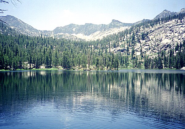
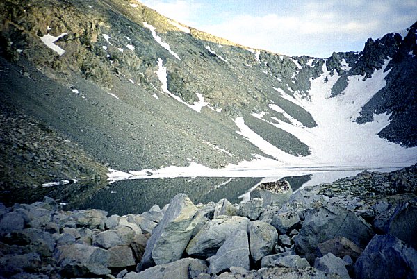
Upper lake in Sixty Lakes Basin |
July 30 -- Sixty Lakes Creek
We waited for the sun to reach us before getting up. It was another
cloudless morning, bringing much appreciated warmth. We descended from lake to lake,
climbing down steep places in between, heading toward the prominent gap in the ridge
separating Sixty Lakes basin from Rae Lakes basin far below. The map shows a trail passing
through this gap, and after a week of seeing no trails and no people, we all longed to see
a real trail. We met it just where we expected to, and shortly thereafter saw a group of
tents (no people). We were planing to follow the trail into Sixty Lakes basin, then cross
the ridge at another low spot and descend to Rae Lakes lower down. It seemed that the
trail was not going where we expected, so we only stayed on it for ten minutes or so. We
passed lake after lake, hiking through meadows filled with wildflowers.
|
|
Sixty Lakes Basin scenery |
|
|
Sixty Lakes Basin Mt. Cotter on
horizon, right-center |
|
|
|
|
Scenery in Sixty Lakes Basin |
|
|
We never did see a trail we could follow for any length of time, but we did see little
rock piles now and then. It was so beautiful, and such good hiking, that we never did
cross over the ridge, but instead followed Sixty Lakes basin to the end, where it finally
turned and dropped towards the canyon floor below Rae Lakes. We found a way down, one that
was very steep but which had intermittent signs of switchbacks on it, as a reassurance
that the route was passable. |
Descent from Sixty Lakes Basin |
|
| Near the bottom, we had to fight our way through brush and swamps. We came across
another animal skull, this one unmistakable as a bighorn sheep because it still had the
long, curving horns attached. The horns must be made out of some different material than
the bone of the skull, because it appeared that the skull would soon crumble into powder
whereas the horns seemed much less affected by the weathering. One of the joys of hiking
off the beaten path is this kind of find. I wish I could have taken one of the horns home
with me, but a combination of conscience and impracticality prevented it. |
|
|
Bighorn Sheep skull |
Finally, after much additional descending, we came alongside the outlet stream of Sixty
Lakes basin. Before I realized it, I was standing on the John Muir Trail. A few yards
further we recognized the drift fence where the we had rested a few years before. It was
there that we said goodbye to a woman who thought she was having a heart attack. (She had
asked us to go for help if she collapsed, but was hiking too fast for us to keep up with
her.) What a sense of relief -- back to civilization.
|
|
We crossed the creek and found a secluded campsite out of sight of the trail. The
food-hanging situation looked marginal, and we expected more trouble from bears now that
we were near the main thoroughfare again. However we had so little food left that it
hardly seemed worth hanging it. Then we noticed a huge pile of bear scat a few feet away,
filled with bits of aluminum foil. We got the food up right away. Actually, the
food situation was beginning to be a concern. One of Roy's dinners, which I had given him,
was infested with worms. And I had either miscounted, miscalculated, or lost a meal,
because we were both down to our last dinner. We had planned to be out two more nights, so
we discussed whether to cook one dinner each night and share it among the three of us, or
to cook all the rest of our food and hike out the next day. We decided to hike out. After
the wildness and beauty of Gardiner Basin, even Rae Lakes seems tame.
So far, we have not hiked later than 12:30 PM any day. Tomorrow we will have to hike
twenty miles. We are in such good shape, and our packs are so light, that it does not even
seem like a big challenge.
Now that we have descended to a lower altitude, the weather has turned warmer again. I
take advantage of this to wash off in the stream. I sit down in the knee-high rushing
water and wash my socks, my shirt, and all the clothes I am wearing. Cold water ! |
Hanging the last of the food |
|
July 31 -- Cedar Grove
|
|
We are all starting to think about getting back, getting that impatient, determined
attitude we left behind a week ago. We pack up our trash and set off down the trail. We
still have not actually come close enough to anyone to speak to them since we left
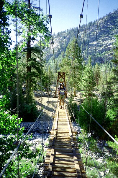
Charlotte Lake. Finally, at Woods Creek, we pass by other parties. We cross the suspension
bridge, and hurry on down the trail, passing people now and then all morning. |
Crossing Woods Creek |
|
At lunch time we arrived at Paradise Valley, originally scheduled to be our last
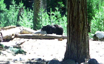
campsite. As we are getting out our lunch, a commotion broke out among the other campers
-- a bear
has just entered the campground. We were told that this bear, last night, had eaten the
food of one of the campers, who had not bothered to put it in the food locker. The
Charlotte Lake ranger had told us that a bear in this vicinity had learned to bluff hikers
into throwing down or leaving their packs by charging at them.
| Sure enough, the bear
came by, making the rounds of the camping spots. I left Roy and Eva to guard the packs
while I went and took a picture. Then I guarded the packs while they went to get water.
Apparently the bear saw them leave, and headed straight for me and the packs. I grabbed
the packs up and stood my ground. Once the bear got close enough to see me, it changed
direction and noisily left the area (almost stumbling into Roy and Eva). Once the bear was
out of sight it stealthily circled around behind us, to have another try. By this time, we
were ready to leave. |
|
|
Bear at Paradise Creek Campground
|
The last ten miles went quickly. Again, Roy and Eva took over the lead, and hardly ever
stopped to rest. We had a snack at Mist Falls, which is where Gardiner Creek joins
Paradise Valley. We stared up the canyon walls, noting the impossibility of getting into
Gardiner Basin by that route. The trail got hotter, dustier, wider, and more populated
every mile further we went.
|
|
As we reached the trailhead, we noted signs about a missing ranger -- the Bench Creek
Ranger ! This is the ranger we had been told to check in with a week before. Now it began
to dawn on us why we had heard helicopters pass over us every twenty minutes, all day
long. As we drove to Cedar Grove we passed by the command post of the search effort, which
included five helicopters and countless rangers. We heard in the store that they had been
searching for three days, and that the ranger had been missing for ten days. The searchers
had commandeered the showers and restaurants, so we had to go on to a campground in the
National Forest to get cleaned up. All I could think about was to get something
crunchy to eat - some salad with fresh tomatoes and carrot pieces. |
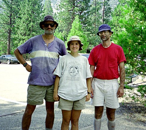
Charlie, Eva, and Roy return to Cedar Grove
|
|
That night we camped in one of those "metropolitan" campgrounds mostly
inhabited by RVs. But we got there well after dark, and left again the next morning before
anyone else was even stirring, so it was not too bad. I managed to give our remaining fuel
to the people next door. As we drove back down to Fresno, we listened to the news, to see
if anything had happened in our absence. The whole Olympics, as it turns out. I still
don't know who won anything.
After a pleasant visit to the campus of Fresno State (Roy's father's alma mater) we
headed on home, again getting the stoves and fuel bottles through the airport security
screening.
PS. They still do not know what happened to the missing ranger. They called off
the intensive search a few days after we left, but continued through September on a much
smaller scale. According to the ranger, they have no clues and no theory about where he
is.
PPS: They finally found the ranger's remains in Window Creek, five years later. I
hear there is a book coming out next year centered on the life of this particular ranger,
which discusses the incident. Here are some reports describing the case.
Bakerfield Californian
Park Service Morning Report
 Go
back to Charles Hayden's Home Page
Go
back to Charles Hayden's Home Page
cchayden@gmail.com