In the fall of 2000 I left my employer of 20 years and joined a startup. The work was satisfying but demanding, and left little time for anything else. I was so busy that I had no real vacation in 2001, and almost did not take one in 2002. When it looked like there would a a lull in the frantic pace of work, I quickly planned a Sierra getaway. I had no time to coordinate a trip with anyone else, so I went alone for the first time in almost a decade. Although physically, mentally, and logistically unprepared, there has rarely a time when I needed to get away more.
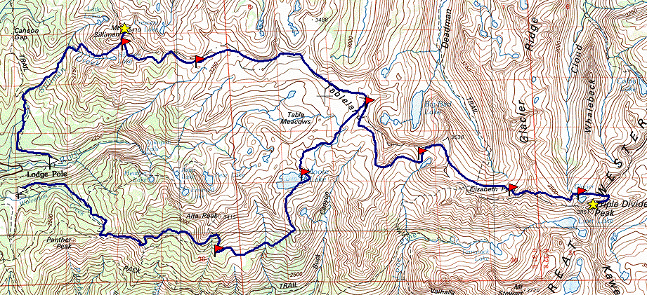
My original plan was to start at Wolvertone, cross the Tablelands, Deadman Canyon, Cloud Canyon, Triple Divide Pass, and descend into upper Kaweah Basin. Then I would cricle around via Pyra-Queen Col, cross Nine Lakes Basin, pass Lion Lake, and circle back to the Tablelands, and end up descending Silliman Creek back to Lodgepole. This turned out to be far too ambitious a plan: I skipped the loop through the Kaweah Basin, but did make it far as Triple Divide Pass.
I was blessed with perfect weather, beautiful flowers, solitude, challenge, and great satisfaction.
You can jump directly to points in the trip by clicking on the map above.
You can click on any of the photos to see a larger version, uncropped and uncorrected. Or you can see the whole gallery here.
You can download the TOPO! source file to see more detail in the maps.
After almost 10 years of hiking in the Sierras with others, 2002 again found me hiking alone. While I truly enjoy sharing the experience with my children and friends, the presence of others changes the nature of the experience. I find hiking solo a more intense, a more challenging, and ultimately a more rewarding experience. On this trip I was determined to visit some familiar and some new areas, and to climb a couple of high peaks.
A few other things were different this year: my pack was heavier and more awkward because I was carrying all my food in bear canisters. I started the trip in less than peak physical condition, due to the demands of my job. And I was not prepared mentally because I had planned the trip in a hurry. But I was eager to get out and experience the wilderness again.
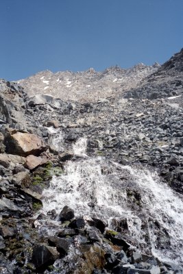
I flew up from Los Angeles and drove up to Lodgepole, arriving at about noon. After getting the wilderness permit and final repacking, I was ready to go at 2:00 PM, a little later than I had planned. Things started going wrong almost immediately. My original goal was to get to Moose Lake on the first day, a trip I had made many times before. But because of the permit system, I had to go via Alta Meadow rather than the easier Pear Lake route. The trail was hotter and steeper than I had remembered, and I was developing a nasty blister.
|
Partly it was that my pack was heavier than ever before, and partly because I missed the turnoff and was heading to Alta Peak instead of Alta Meadow. Eventually I spotted the meadow far below, and stumbled directly down the slope and made camp. I just barely had enough energy to set up camp, replenish my water supply, and make dinner. The full moon and the usual problems of acclimatizing to the altitude made for fitful sleep, which is normal for the first day out. |
|
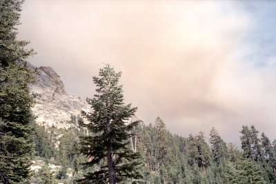
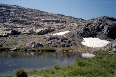
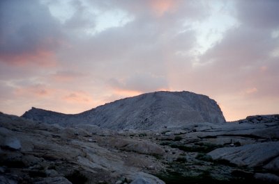
| Smoke on Alta Peak Trail |
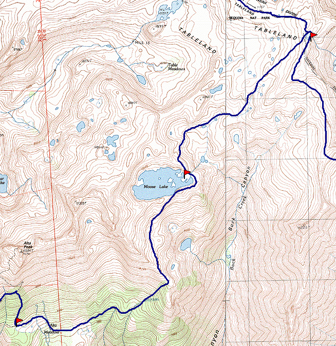
Map 1 - Alta Meadow to Upper Big Bird Lake
| The might was warm, and smelled a little of smoke. There is a controlled-burn near Wolverton -- it must be smoke blowing up from that at night. I spend some time working on my blister. Perhaps it was caused by a new insole in my hiking boot, which changed how they fit, or perhaps because I had worn these socks on a hike a few days before and had not washed them, but the blister is pretty bad. I applied NewSkin, which stings like the dickens when applied to raw skin. There is another party camped at Alta Meadows, but I am up and away before they stir from their tents. |
|
|
| Alta Meadow |
|
It is a struggle to get to Moose Lake by lunch time. The route is familiar -- I
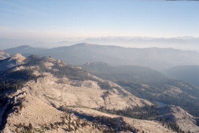
have been this way before -- but is brutally steep. The views of Buck Canyon,
normally spectacular, are obscured by smoke and haze. After arriving at the southern
lip of Moose Lake and having lunch, I skirt around it to the beautiful campsites on the
north side. Feeling tired and weak, I decide to stay put for a while, and put up the
tent fly for shade and take a nap. After the nap, I decide not to hike farther that
day, but to stay put. Late in the day another party appears on the far side of the
lake, and slowly makes it way round toward me, and camps a quarter mile away. It is
not clear if they see me. During the late afternoon and all through the night I am constantly being buzzed by hummingbirds. They zoom by so quickly it is hard to see them. I sleep better than before, but am bothered by the smoke again. |
|
| Moose Lake |
| It is becoming clear that my original plans are not at all realistic. I have
taken two days to get where I had planned to be by the first day, and I am feeling no
stronger. During the night I formulate a plan to hike to Glacier Lake and back, then
to go on to Mt Silliman if possible. This plan bypasses much of the most difficult
and uncertain new terrain, but keeps me from doing too much descending and climbing,
something that is causing much of my suffering. With this new plan in mind, I set out early. Before I have gone more than a few steps, I encounter one of the party that had camped nearby. The two of them are in a Yosemite trail crew on temporary assignment to Sequoia. They spend their time off hiking in the backcountry, and had come in from Wolverton the day before. |
|
|
| Making Breakfast at Moose Lake |
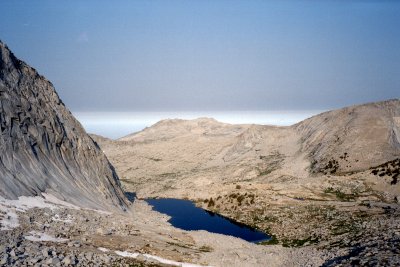
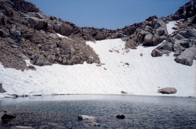
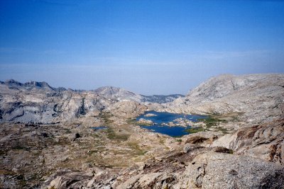
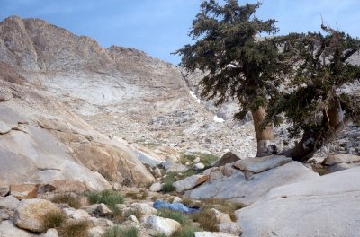
| It is still a struggle to climb to Upper Big Bird Lake. I get there about lunch time, and can go no further. Can I even get to Glacier Lake ? There is a pretty stiff wind: Upper Big Bird Lake is at the very top of the Kings-Kaweah Divide, where the wind tends to be the strongest. I search for a sheltered spot to rest, eventually finding a place on the east end of the lake. At least the wind has cleared the smoke from the sky and blown away what few mosquitoes there had been before. |
|
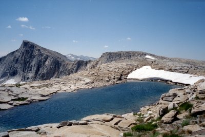
|
| Upper Big Bird Lake |
|
The marmot at this lake is fearless -- he walks right up to me to investigate my boots, my pack, and my food. I hope he does not gnaw a hole in my boot or chew off a pack strap. No matter how many times I scare him off, he is back in a few minutes. Finally I empty everything I can into the bear canisters, stuff the backpack into a stuff sack, and keep my boots nearby at all times. | |
| Marmot |
I have been having an upset stomach every evening after dinner, so I decide to skip eating dinner and feel much better. The wind dies down completely at sunset, but the smoke again comes back. It is enough to wake me up with watering eyes. I finally get a good night's sleep, in part because the moon does not rise for a few hours after sunset. For the first time, I can appreciate the stars. I wake up suddenly once, feeling like something is touching my neck. I don't know if the marmot was trying to lick me, or if I was just dreaming, but I am too tired to worry much about it.
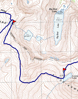
Map 2 - Upper Big Bird Lake to Lonely Lake
I decide to cache one of my bear canisters near Upper Big Bird Lake, and to pick it up on the way back. I put four days of food into my other canister, and also leave some of the fuel behind. I have developed a blister within the much larger blister. It looks terrible, especially when I first take off my boots, but I try to allow it to dry as much as possible. It does not hurt too much while I am hiking, but I am definitely favoring it. I decide to try some new bandages I bought just before the trip, and although they are usually rubbed off by the time I finish my hiking every day, I am convinced they helped.
I am suddenly much more comfortable hiking. Perhaps it is that I am finally getting into better shape, but undoubtedly it is the lighter pack as well. I am headed over Pterodactyl Pass to Lonely Lake. Climbing is still hard, and I work harder than ever before at maintaining my altitude when crossing between Pterodactyl Pass and Lonely Lake.
| I get to the lake by lunch time and take a rest in the shade. But for the first time I feel like going on after lunch. But there is no good stopping point for a long way, so I move a little up from my first stopping place to a little subsidiary lake above Lonely Lake, and then explore all around the basin. |
|
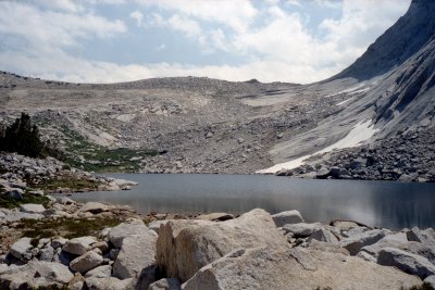
|
| Lonely Lake |
|
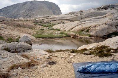
Because the weather was warm and dry, I never put up a tent.. | |
| Campsite Above Lonely Lake |
| The night is warm -- it has been warm every night -- and even though I sleep with the bag fully unzipped it is noticeably damp around the feet. This seems to be increasing, even though I take the time to dry the bag in the sun every morning and every evening. While I am mulling over what to do, the wind picks up and the bag dries out quickly. |
|
|
| Sunset |
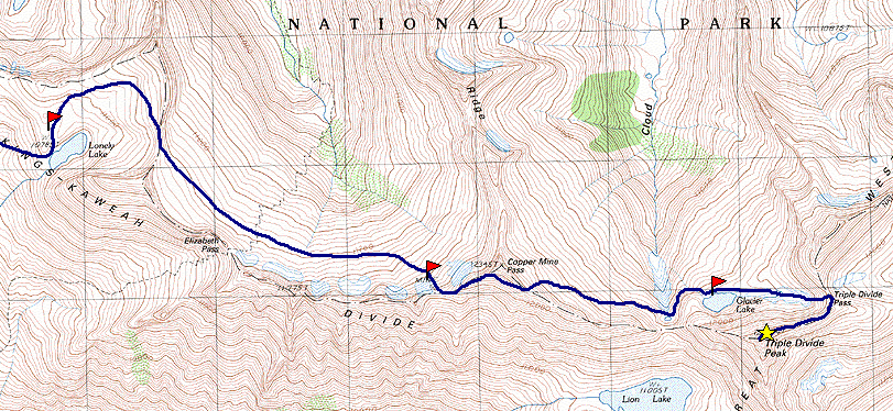
Map 3 - Lonely Lake to Glacier Lake
|
This will be my most ambitious day so far. I am finally getting the endurance that I should have. Although I am up late and only get started by 10, I continue until 4. I stay to the left, off the cliffs, in going over the pass to Deadman Canyon. | |
| Lonely Lake From Pass |
| As usual, the progress around the top of Deadman is slow and painstaking. After reaching the copper mine, I forgot that there is still a lot of climbing to get to the pass into Cloud Canyon. In crossing Cloud Canyon, I stay as high as possible, and end up crossing lots of snow fields. |
|
|
| Deadman Canyon From Coppermin Pass |
|
I spotted the faint use-trail beneath the black cliffs guarding Glacier Lake, and made sure I kept enough altitude to use it. This made the crossing much easier and much less of a mental strain. | |
| Route To Glacier Lake |
| The final climb up to the lake is still a struggle, but it has been a long day and I feel much better mentally. |
|
|
| Triple Divide Peak Glacier Lake Outlet |
|
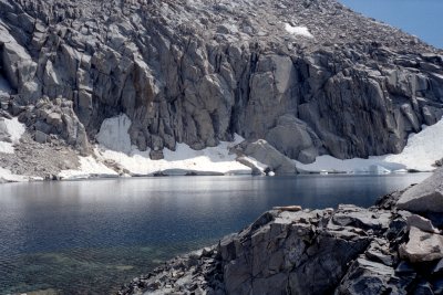
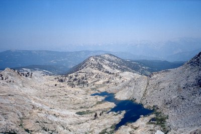
The water in Glacier Lake is still painfully cold, but I am determined to wash my socks every day, so that I always have a clean pair. I think clean socks help with the blister, which I am still nursing along. I watch as big shelves of snow break off and fall into the lake, break up, and blow across in my direction. Again I skip dinner and feel much better, so I decide "No more dinners." Nestled into the little ledge by the lake, shielded from the moon rise by Triple Divide Peak, I sleep really well for the first time. |
|
| Glacier Lake |
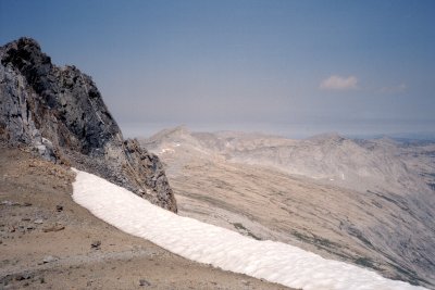
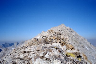
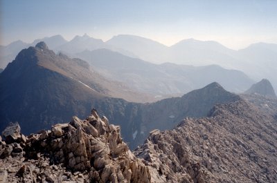
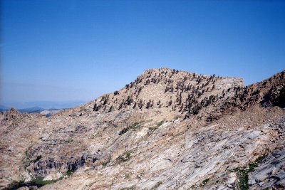
| The last time I climbed Triple Divide Peak was 1989, although I had been as close as Triple Divide Pass in 1997. The first time I climbed the peak was 1977, so this would be the 25th anniversary of that climb. I started as early as possible, climbing up to the pass before the sun emerged from behind the ridge. I climbed the chute to the right of the white/black boundary, staying to one side when going up the last, steepest parts where the booting was unstable. It was surprisingly easy, as I was now climbing without any but the lightest day pack. Once I was on the ridge, the route looked truly frightening, but at each juncture there was a safe way to go. I kept it up, determined to find a way up. |
|
|
| Trile Divide Peak - South Ridge |
|
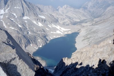
When I reached the top, I found that the register had been replaced in 1991, so I was not in it. Two parties this year had signed before me. It looks like the peak is now a regular destination for Outward Bound parties -- I am glad that I did not run into one of them. | |
| Lion Lake |
| How to navigate inside QuickTime VR scene: Hold down mouse button and drag in the scene to change your viewpoint. Zoom in by using the Shift key, zoom out with Ctrl key. |
||
| View From Triple Divide Peak |
| The descent was as frightening as the ascent, but I made it safely down without incident. |
|
|
| Triple Divide Pass From Peak |
|
I had been debating whether to spend a second night at Glacier Lake, or whether to go on. Part of the problem is that there is no good stopping place short of Lonely Lake. But it was so early when I got back to camp that I decided to pack up and move on. I decided to fill up all my water bottles so I could stay anywhere I would fit, and set off for the copper mine. | |
| Pass From Cloud Canyon To Lion Lake |
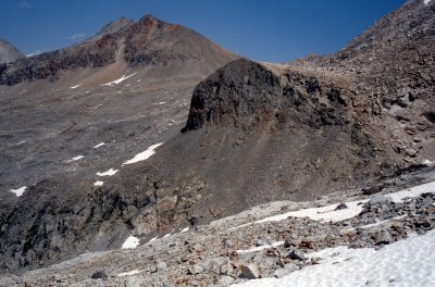
As before, with Chris and Lisa, the correct notch for Coppermine Pass was difficult to find. I had just come down this the day before, and had turned around and taken note of the route, so it should have been a simple task. But it was not. I knew there was a trail, but I could not find it, and began to suspect I might be going too far. The GPS indicated, with no ambiguity whatsoever, that I had gone way too far. The GPS was wrong. It was set from the map, which is really unclear, and not from when I had passed through the day before. I kept going as my intuition told me, and eventually found the trail up to the pass.
As I was resting at the pass admiring the Lion Lake basin, another hiker suddenly appeared coming from the copper mine. This was another Yosemite trail crew member, hiking to rendezvous with his brother, a Sequoia trail crew member, at Lion Lake. After asking my advice and dithering for half an hour, he headed down toward Lion/Tamarack. I had told him to stay east, that there were cliffs around Tamarack Lake that were all but impassible. As I descended toward the copper mine, I could see him descending farther and farther down without contouring toward Lion Lake. Hope he made it there all right.
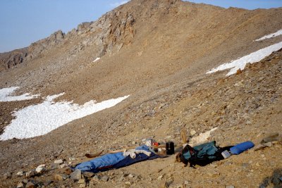
| The no-water camp at the copper mine was lovely. I had soup for dinner and was not hungry for more. The view from the sleeping bag was spectacular, but a little worrisome because it was sloped, and there was no lip or anything to keep me from sliding down the mountain. I don't know why I didn't just stay at the pass, except that the snow field would have been difficult to cross first thing in the morning. Great star-viewing -- shooting stars, satellites, the milky way. |
|
|
| Campsite at Copper Mine |
|
I am getting stronger every day, at least I think so. The load is getting lighter, and there is a lot less of the brutal ascents. The walk back to Lonely Lake went quickly and pleasantly, and I managed to keep high on the canyon's rim. At Lonely Lake I decided to rest in the shade and then hike on to Upper Big Bird Lake. I had scouted out a couple of huge rocks that made a good shady spot, but it was too chilly there. Instead I laid down in the grass nearby, with numerous bees buzzing around the abundant blossoms growing everywhere. I realized that I was finally over the fastidiousness that I had started with -- I am in equilibrium with the dirt, so I might as well lay on the ground as on a ground cloth. I covered up from the sun and had a very pleasant nap in the cool grass listening to the bees. |
|
| Resting Spot Near Lonely Lake |
I spotted another solo hiker in the vicinity of Lonely Lake, but I passed by without him seeing me. After a few hours of rest, I resumed walking, continuing across Pterodactyl Pass to Upper Big Bird Lake, the food cache, and the marmot. I arrived at 5 PM, the longest day so far. Again the night was warm and calm, with eye-stinging smoke.
Since I have stopped eating freeze-dried dinners, my stomach has been a lot happier. Trail mix, power bars, and soup mix is all I want and it works a lot better. But my previous problem has led to a critical shortage of toilet paper. Will it last ? I discover an emergency supply, which calms me a bit.
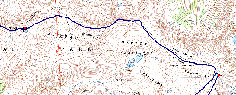
Map 4 - Upper Big Bird Lake to Lake 10410
| I am hiking along the Kings-Kaweah Divide. Carrying both bear canisters is harder, but now they are getting lighter and don't seem such a burden. I have been able to pack some of my equipment in them, and squeeze the sleeping bag into the main backpack compartment, which helps my balance considerably. |
|
|
| Kings-Kaweah Divide |
|
There is a lot of up and down, and lots of spectacular scenery in the canyons to the north. | |
| Lake 10315 in the West Fork Ferguson Creek |
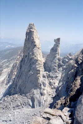
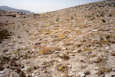
| I had been this way long before, exploring almost all the way to the pass near Lake 10410, while based at Upper Big Bird Lake. I remember especially the two spires between Box Canyon and Ferguson Canyon. The wildflowers are spectacular too, covering the bare rock and sand with color. |
|
|
| Box Canyon Spires |
|
Tomorrow's pass is beginning to worry me. By now I recognize how steep the other side is going to be. After a full day, I reach Lake 10410. I could go further, but I need to be fresh to tackle the pass. so I stop. Since I left Upper Big Bird Lake, I have not seen a single footprint, route marker, campsite, or any other sign of hikers. This is really a less-traveled area of the wilderness. Lake 10410 is pristine, and I keep it that way. I am still bothered by the blister, but it is getting no worse. After trying for days to dry it out, I realize my feet are so dry that they are cracking. I switch to another tactic: keeping my socks on at all times. There is really no "dirt" anywhere around, and the grass is clean and soft, so I can dispense with the sandals and just wear socks around camp. The bandages also seem to help, and are staying on better. |
|
| Meadow above Lake 10410 |
About midnight I wake up to howling, which seems to be close by and coming from many points all around me. It sounds like dogs or coyotes. But I am over 10,000 feet, so it seems unlikely to be coyotes. After a few minutes the howling dies down, and I fall back asleep.
Map 5 - Lake 10410 to Silliman Meadow
| I thought that getting down the pass would be a big deal, but just getting to it was an ordeal. It took until noon to get there. There were a lot more wrinkles between Lake 10410 and the pass, meaning lots of effort to stay high. I contoured across the forested slope, which was surprisingly steep. It might have been a lot easier to descend the outlet stream of Lake 10410 and then ascend the crack that led to the pass, but from the lake it was impossible to see the way (either way). |
|
|
| Pass is Notch at Right |
|
Once I made it to the pass, I intended to sit down and eat lunch and plan the descent. But I could not sit still long enough to get much rest. I explored the slopes to the left and to the right, and eventually found that by going left at about the altitude of the pass, I could get onto a moderate slope, where I could make my way down. My heart was singing, knowing that I would be able to make it down to the Silliman watershed instead of having to backtrack to Pear Lake. But about 2/3 of the way down, I ran into a series of cliffs of about 20 feet, each of which threatened to block my progress. For each one, I found a way down. It was a big relief to finally get to the bottom. I made camp at the foot of Mt Silliman. The lake below is Silliman Lake, so I called the lake I was staying at Upper Silliman Lake. It was surrounded by large rocks, but it had a single tree a short distance away. I made my camp by the tree, the first one I had camped near since Alta Meadow. It was a great campsite, and again completely devoid of any signs of previous visitors. |
|
| Campsite Upper Silliman Lake |
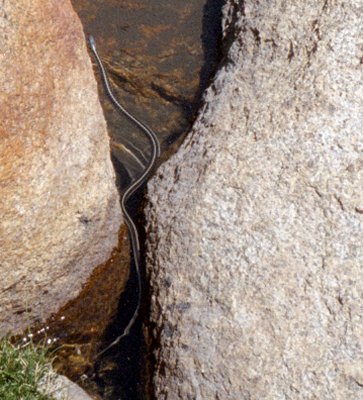
| While I was getting water, I saw a gray coyote trot up Silliman Creek. When it saw me it froze, then ran quickly away. I suppose it was a coyote, but it was gray, not yellow, and was at over 10,000 feet. It was thin and had long hair, kind of like an Irish Setter, but with pointy ears. Whatever it was, it explains the howling I heard last night. A few minutes later I saw a snake. |
|
|
| Snake |
|
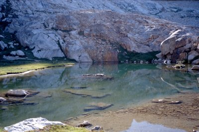
While I was sitting on the rock contemplating the lake below, I spotted a faint use-trail up the creek, turning to follow a crack up Mt Silliman. I resolved to get an early start tomorrow. | |
| Upper Silliman Lake |
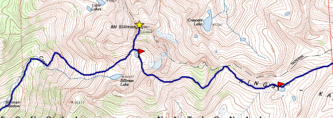
| I set my watch alarm to go off at 6:00 AM, which to my surprise was still dark. I made breakfast in the dim pre-dawn and was started up Mt Silliman by 7:30. The route up the peak was pretty well-traveled for about 1/2 the way, then it turned to stable talus, so I made good time. By 8:30 I was on top. The sun was still very low in the east, but in the other directions the views were gorgeous. |
|
|
| Beville Lake and Ranger Lake from Mt. Silliman |
|
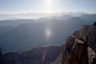
Haze still hung in the valleys of the north, with tier after tier of mountains stretching away. Mt Silliman is a lot easier than some of the others. Maybe it could even be done as a day hike from Lodgepole. But only two parties had signed the summit register this year. | |
| Great Western Divide From Mt. Silliman |
| I descended back to camp, packed up, and headed down. I noticed that one section of the descent, below Silliman Lake, was pretty steep. I tried sticking to the far right (north), with the aim of getting on the gentler slopes of the Little Lakes drainage. But I eventually ran into some steep spots, so I headed straight down the last part of the canyon, over the big rock slabs. I managed to get down, but it was nerve wracking. There must be a better way. At the bottom of this enormous slab there was a really nice campsite at the edge of a meadow and near the stream. From this point down, there was a clearly-visible trail that was easy to follow and obviously much used. I suspect that this trail continued up to Silliman Lake somehow, bypassing the steepest and most worrisome sections of rock, but I never located it above the campsite. |
|
|
| Silliman Canyon |
I decided that, rather than stay overnight at this campsite, I would continue to Lodgepole, drive down to Fresno, and get cleaned up before flying to Berkeley. The use-trail stayed to the east of Silliman Creek through meadows and stands of trees, until it joined the JO Pass trail. The trail up Silliman Creek was not particularly visible from the main trail, but joined it just where it crossed Silliman Creek.
The rest of the way down was uneventful, but I saw no one until I was actually in the Lodgepole campground. After taking some refreshment at the grocery store, I got a ride back up to Wolverton with a pair of friendly vacationers who had ascended into the Tablelands via the Tokopa Falls trail.
Satellite Phone
Although I truly love hiking in the Sierras, it is not without costs. One of these costs is the worry it causes those close to me (mainly my wife), who don't know for a week or more if I am safe. I have considered several ways to address this. A few years ago I began to look into personal rescue beacons, such as this one. At the time they were very expensive, heavy, and were not authorized for anything other than aircraft and boats. More importantly, a rescue beacon would not provide any assurance that I was safe: there are plenty of circumstances that I could be in trouble and not able to activate the beacon.
More recently, I looked into satellite phone systems such as Iridium. Until lately, these were also very expensive to own and to operate, and they also were heavy. But recently the Iridium system (through its reorganization under bankruptcy laws) has become much less expensive to use. I found a service provider, MZ Communication, with reasonable rates. I also discovered that there is a market in used phones in Ebay, typically selling for 1/10 of their original proce. So I bought a used phone and brought it along as an experiment. Here is how it worked out.
The phone itself, a Kyocera SS-66K, weighs less than a pound, but it is heavy and bulky compared to the current generation of cell phones. It seems rugged, which is good, and it has a substantial battery, which gives it two hours of talk time. Originally costing $3,000, I bought it used on Ebay for $300. The phone had most of the features standard on cell phones: a directory, incoming text messaging, various ring tunes, etc. The voice quality was excellent.
The trouble with satellite phones is that they need to be able to "see" a satellite to communicate. My experience watching satellites pass overhead suggests that they pass from horizon to horizon in a few minutes. Thus any conversation of any length is likely to require a handoff from satellite to another. There was never a time when I could not establish a phone call, although sometimes I had to wait a few minutes until the "signal strength" meter permitted it. But once establish, the call was likely to drop within two or three minutes. Once I stayed on a call for five minutes and it did not drop, but more often the system would disconnect the call before I was done talking. And often after this happened, I could not establish the call again until a few minutes later. My theory on this is that the call lasted until the satellite passed from view, and then dropped when another one could not be found to switch to. I don't know if this experience is typical or reflects some problem with my equipment, but I would be interested to hear of other people's experiences.
But overall, the phone did its job of reassuring my family that I was safe and sound each day, and letting them know where I was staying each night and where I was heading the next day.
Some people decry the use of technology in the backcountry, especially communication technology like a satellite phone. I am much more pragmatic: if it makes it more acceptable for me to be away doing what I love, then it is worth it. I don't believe it "destroyed the wilderness experience" for me, because it punctured only a tiny hole in the isolation, and the isolation is not a big part of what I am trying to experience anyway. I was much more worried about the effect it would have on my judgement of danger, knowing I had a way to call for a rescue if necessary. My experience with an altimiter watch, and more recently with the GPS, had taught me that knowing I could call for a rescue might dramatically lower my own level of attention and caution. I tried never to think of the phone as a way to call for help, only as a way to check in. How successful was I in this ? Two scraps of evidence suggest the answer. First, I did program in the number of the Park Service backcountry office, so that could call them in an emergency. But when climbing and otherwise hiking away from camp, I always left it behind. In any case, I did not need to call for help, nor can I recall any time in all my hiking when I would have used a phone in that way if I had had one.
Bear Canisters
The Park Service is getting more and more insistent on protecting food from the bears, to which the bears are getting more and more adept at stealing food from hikers. More and more places require bear canisters, and I have heard the long-term plan is to remove the bear boxes and require all hikers to carry canisters. In the past, I have relied on being above tree line to protect me from bears. But increasingly, bears are going above the trees, where it is much harder to protect the food. I have had to defend my food from a bear in Nine Lakes Basin, but without trees or other natural protection, this meant I had to stay up half the night watching. So when I saw two used bear cannisters for sale on the internet I decided to buy them.
The cannisters are made by Garcia Machine, and are the most widely used kind. I could fit five days' food in each, just barely. In hindsight, I took a lot of unnecessary food, but I doubt that I could have fit 10 days food into one cannister. I suppose if I had been willing to go hungry I could have done it.
Although I have a huge backpack (as big as they come) I could not fit two bear canisters, a sleeping bag, pad, and tent, and everything else, into by backpack. Something had to strap on the back, sticking out and costing my my balance. I strapped the sleeping bag on the outside, since it was a little smaller and lighter than the canister. Perhaps I would have ben able to fit it inside if the food had been in stuff sacks. After I had used up a lot of the food, and had put other equipment in the canister, I did manage to fit everything inside, which made for much more comfortable hiking. But the main disadvantage of cannying the canisters, the extra weight, was with me the whole way.
But the bear canisters did have their benefits. First and most important, I could sleep confident that my food was safe, not only from bears but also marmots and other rodents. Second, I did not have to worry about the arduous chore of hanging the food. This takes a lot of time and energy, and must be done first thing after arriving in camp, just when you most want to sit down and rest. Third, the canister made it possible for me to cache my food for a few days, while I was traveling to Triple Divide Peak and returning. If I had no secure way of protecting it, I would have had to carry all the food with me. Finally, the canisters do make great stools for those times (like at the copper mine) when there is simply nothing to sit on. And one additional bonus benefit -- after using some of the food, I could store my most fragile equipment (starting with the satellite phone) inside the canister, protecting it from harm.
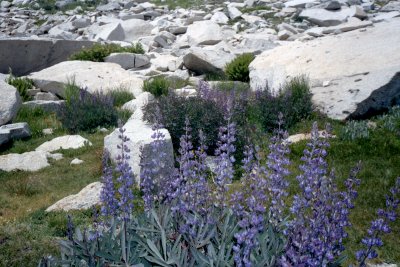
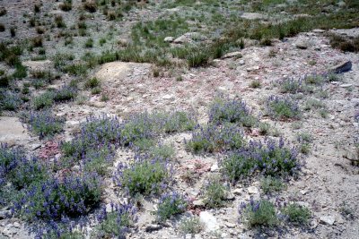
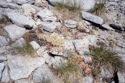
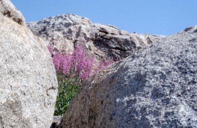
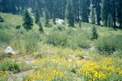
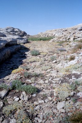
Wildflowers
By visiting in July rather than August, I caught the peak of the wildflower season at the higher elevations. I cannot recall seeing a greater variety or a greater abundance of flowers. Although photographs rarely capture the grandeur of flowers in the wild, I could not resist trying
Solo Hiking
When I was much younger, I hiked alone almost exclusively. In the past decade I have have mostly been hiking with others, partly because of the pleasures of sharing the experience, and partly with the encouragement of my wife, who is thinking of my safety. This year I could not find anyone else to come along, so I returned to hiking solo. The satellite phone provided a kind of answer to the safety issue. Hiking alone is different in many ways.
One of the most powerful, if superficial, benefits of hiking alone is that you can go at your own pace. When I was younger, I hiked fast and I could do it for 12 hours straight. I would have to slow down when hiking with others. Now I am slower and I need to stop earlier in the day. I am compelled to push myself to keep up, and to go on when I would rather stop. I feel like I am being judged on my fitness level. Hiking alone , some of these factors still come into play, but they are entirely internal: I should to faster and farther because ... well, I just should. I usually manage to conqer these feelings in the first couple days, and then I am completely at ease with my pace. When I am with others, this never hapens.
When I am hiking with others in the Sierras, I am the most experienced, and feel responsible for planning the itinerary. In choosing where to go, I am reluctant to pick some place I have never been, so I wind up picking some really wonderful place I have been before. Not always, but usually. As a result, I miss the adventure of exploring new places, the discovery of the unexplored. It is great to go back to places with wonderful memories, but a measure of newness is important too. In this trip I was able to go up Mt Silliman for the first time.
Although it is undoubtedly safer to hike with others, this safety is purchased at a cost. When I am alone, my own safety is the only thing that matters, and I am (at least partly) in control of it. With others, I feel like I am responsible for everyone's safety; there are a lot more ways things can go wrong, and I cannot control the risks other people take. For instance, if someone else is acting careless, I can't really make them stop, but I will have to deal with the consequences if something happens. In many ways, I would much rather get hurt myself than have to deal with all the consequences of the same thing happening to someone else. Although, in fact, I don't hike with others who I consider irresponsible or careless, I personally do not consider adding others to my hiking party decreases my concern with safety: it only increases it.
One of the pleasures of hiking with others is reliving the experience of discovery -- of seeing cliffs, peaks, canyons, meadows, and streams for the firs ttime. In other words, it is a joy to share these memorable sights and challenges with others. But there is a tension, one which I have never found a satisfactory answer to. I learned most of what I know about hiking and exploring to trail and error -- by making mistakes and learning from them. If I simply lead the way, tell people how to do things, give them the end product of many years of my learning, will they really have the experience they should ? If I stand by and provide no guidance, am I not simply wasting time and energy in being superior, almost sullen ? If I know something won't work, how can I justify watching someone else try and fail over and over ? The problem starts long before the trip itself: should I provide guidance to my conpanions on equipment, packing methods, food, etc. ? The correct answers to these questions depend, of course, on the people involved and in how much advice they request. But the fact remains that, at almost every moment of the enterprise, part of my mind is occupied with the question of what my role should be -- leader or team member, mentor or participant.
I daresay most of us spend very little time with our own thoughts. I know I don't. I am always busy: doing chores, preparing meals, working, reading a magazine. If I need entertainment, there is always the TV. In the car, there is the radio. In the airplane, I always bring a book or music or a book on tape. The only time my mind has to wander freely is when I run, for I never carry a walkman. Most of us could go for days or weeks without having to really think our own thoughts. One of the most remarkable thingsabout hiking is the time it gives us to think. My mind dredges up memories that have been buried for years: childhood friends, forgotten accomplishments and embarassments, things that are right and wrong in my life, things I should do and things I should stop doing. Occasionally I will realize that I should change something fundamental in my life. Sometimes I even do it when I get back. More often, the intention simply evaporates in the hustle and bustle of "normal" life. But more and more I am coming to believe that in 10 days of hiking I manage to do more real thinking than I do in all the rest of the year put together. I am coming to understand that this state of mind takes two or three days to achieve: that it takes this long for all the distracting day-to-day things to drain away. Furthermore, the presence of other people dilutes or destroys it. It is only fully experienced alone because the presence of others is so distracting.
The flip side of this phenomenon is the bonding that takes place when sharing an experience such as a wilderness hike with other people. It is an unforgettable experience, something that, whatever else happens, you will always share with your companions. It is chance to get to know other people more deeply than is ordinarily possible. My Sierra trips with my sone and daugher are treasured by all of us, and my hikes with my father are similarly beyond compare. So this is the tradeoff -- getting to know yourself better versus getting to know others better. There is no right answer, it is just a different experience.
To view QTVR scenes, download the QuickTime software from Apple's QuickTime Web site
![]()