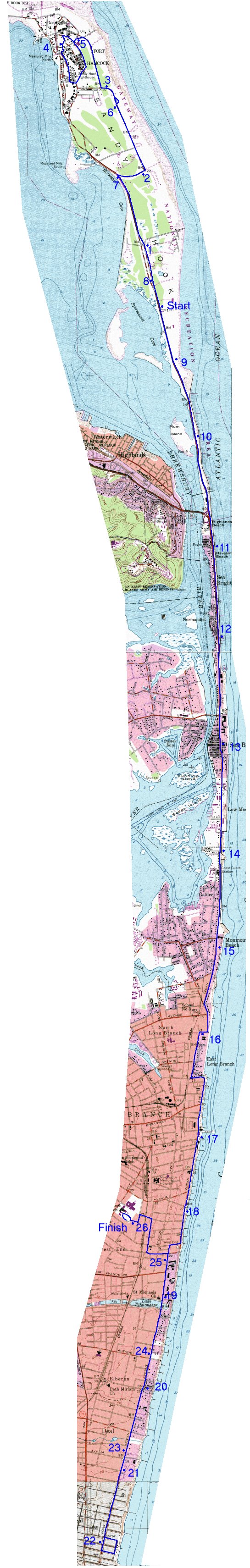
This is based on a detailed course map provided to me by race organizers. This should not be taken as official: in a few places there is some uncertainty in my mind due to changes in roads between the time that the base maps were made and current conditions.
The race starts going north, loops around Fort Hancock counter-clockwise, retraces its steps and then follows the coast all the way to Deal, makes a clockwise two-block loop, and returns up the coast before turning into the High School.
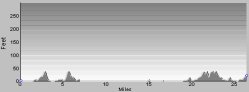 As you can
see, the course is essentially flat. The higest elevation is about 50 feet.
As you can
see, the course is essentially flat. The higest elevation is about 50 feet.
![]() Return to Running Map Summary
Return to Running Map Summary