April 1, 2006 - Doubletop And Big Indian
Since I have completed the 39 climbs required for the 3500 club membership, I have
found my motivation to go hiking in the Catskills has dropped a little. That is
probably healthy, since near the end I was almost obsessed with finishing. Now it is
back to normal -- I go for the pleasure of hiking, exploring, and camping. A little
of the "exploring" motivation is gone, but there are still new routes and new
trails I have not yet traveled. I can still work on my winter patch, but that is so
far away that it does not exert much of a pull yet. Besides, it is no longer winter.
But mostly completing my 39 peaks has left me without an organizing principle -- what
do I try next? for now, I am finishing up on a couple projects I started partway
through -- measuring the GPS coordinates of all the peaks, springs, and other key
features, getting pictures of all the canisters, things like that. I also want to
visit all the crash sites that I can find. After that, I will have to find some
other reason.
The "purpose" of this hike was to fill in several holes in my GPS list as I
could: the Doubletop and Fir canisters, several features on Pigeon Brook, and the
Doubletop crash. I did not accomplish most of these, so it means I get to go back!
|
|
The weather forecast was for rain and temperatures in the 40s. Not the best
weather for hiking. But Friday was gorgeous -- sunny and temperatures in the 70s,
and Sunday was predicated to be sunny too, so I took a chance. The plan was to climb
Doubletop on Saturday and explore the Panther crash site on Sunday. I drove up on
Friday night, and spent the night near the Biscuit Brook trailhead were it rained off and
on through the night. When I set out in the morning it was very cloudy -- more like
thick fog -- but not raining. I hiked up the Biscuit Brook trail to the YMCA
property line, and followed that across to Doubletop. This is the same route I took
in May 2004. |
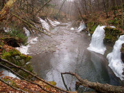
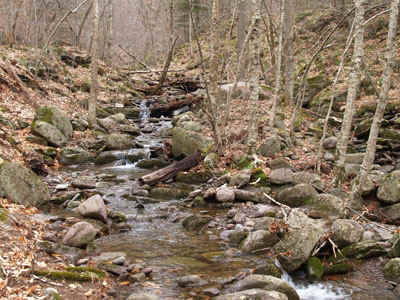
| Pigeon Brook Crossing |
|
| I was surprised how many details of that hike I remembered: the rises and falls
of land on the way to Pigeon Brook, the steep slopes bordering the brook, the confusing
slopes after crossing, the steepness of the final approach on the ridge. |
|
|
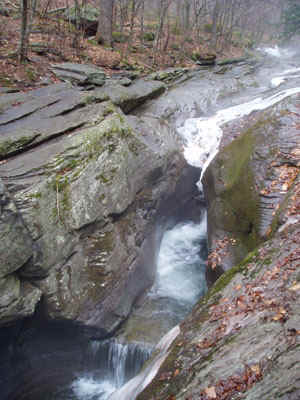
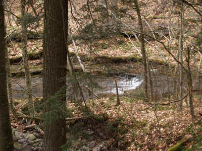
Pigeon Brook Narrows |
|
|
So we made it up to Doubletop by noon, in about four hours. I remember last
time how I spent so much time searching for the canister on the wrong peak, simply because
I had marked it wrong on my GPS. I remember thinking I was following the ridgeline,
only to unexpectedly come right back to my starting point. Well, the same thing
happened again! I still had the wrong waypoint on my GPS, and after heading to the
other peak for a ways, and then cheating and using the GPS to find it, I went right back
to the wrong peak. I chided myself, put away the GPS, and used the compass. |
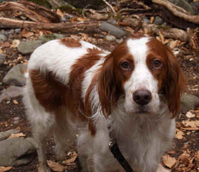
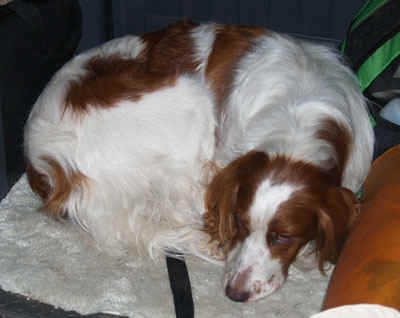
| Doubletop Canister |
|
| his time I brought along Rosie, my Irish Setter. She is a pretty hiking
companion, but I am beginning to conclude that she really does not like hiking off the
trail. As long as we are on a trail, she walks ahead of me, having a good time.
But off the trail, she drags behind, she goes on the opposite side of every sapling,
she pulls this way and that. She really disapproves, I guess. If I trusted her
off the leash it would be different. but as it is, she really slows me down. |
 |
|
Rosie |
 |
I have recently been reading Paul Repak's article about observational navigation (http://adkhighpeaks.com/forums) and it
reminded me about how lazy I have gotten about navigating with the GPS. I tried to
rely mostly on my compass, which actually works even better than the compass on a GPS.
The GPS seems to be exquisitely sensitive to whether you hold it level, whereas the
compass needle levels itself. Still, because of the limited visibility, and my haste
to get going due to the rain and wind, and because my map was disintegrating from being
wet, I neglected to check the bearing leaving Doubletop, so I wandered a little south of
the ridge, putting me on the steep part of upper Pigeon Brook. Finally I puled out
the GPS and saw what was wrong, but by then I had to hike a couple hundred feet up to the
saddle, in addition to the climb up to the trail junction. Next time I will be more
careful. I used to be able to navigate without the GPS. |
| Biscuit Brook Tributary |
|
| A big notice at the trailhead warned that there was deep snow and ice at the higher
elevations. Somehow, I doubted this but nevertheless I want back to the car and got
my crampons. There were some patches of snow and ice on Doubletop and its ridge, but
nothing remotely requiring crampons, so I carried them all day for nothing |
 |
|
Biscuit Brook near Lean To |
 |
We were both pretty wet and tired by the time we got to Big Indian. The original plan
was to cross the ridge to Fir, and then return to the lean to. Because it was
getting late, I decided to just return on the trail. Lower down the wind subsided,
the sky started to clear, and the day turned pretty pleasant. It took nearly three
hours to return from Big Indian, but by the time we got back to the car we were starting
to dry out. |
| Rosie on the drive home |
|
What I learned from this trip:
- no backpack is waterproof
- protect the map from getting wet by using a plastic bag
- keep the GPS in the backpack, to remove the temptation
- check snow conditions before leaving
- no more bushwhacking for Rosie
Go To Catskill Hikes Page